How to drive the Lofoten National Tourist Route on the Lofoten Islands?
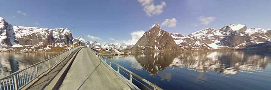
Located in the Lofoten Islands of Norway, anchored above the Arctic Circle, the Lofoten National Tourist Route is a drive that provides stunning views of the ocean. It’s one of the most scenic drives of Norway.
How long is the Lofoten National Tourist Route?
The route, part of the E10 road, is 230km (142 miles) long, running between the bridge across Raftsundet in the north of the islands to Å in the south.
Is the Lofoten National Tourist Route paved?
Located in Nordland County, in the northwestern part of the country, the road is mostly paved and comprises a few narrow parts.
Is the Lofoten National Tourist Route worth the drive?
The road provides stunning coastal views: a memory for a lifetime. This journey is an amazing experience and a must-visit for all driving enthusiasts. This is definitely one road trip that you want to record with lots of photographs along narrow roads that tirelessly follow the outskirts of mountains, through tunnels that open to great wide vistas.
Facts:
Roads: Euroroute 10, Road 807, Road 811, Road 825, Road 992, Road 994, Road 807
Length: 230km
Highest elevation: 59m asl
Ferries: 0
Winter notice: Open to traffic throughout the year. May be closed for short periods in winter when the weather is bad.