How to drive the Havoysund National Tourist Route in northern Norway?
Located in Finnmark County, in Norway, the Havøysund National Tourist Route is one of the most scenic drives in the country. It's a challenging route and boasts a varied landscape including views of the beach, fjord, and mountains.
How long is the Havøysund National Tourist Route?
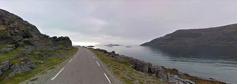
The road, County Road 889 (Fylkesvei 889), is fully paved and runs south–north between the villages of Smørfjord and Havøysund. It’s 85.7 km (52 miles) long. The road hugs the shore, passing by naked rock in a barren and untamed landscape.
Is the Havøysund National Tourist Route worth the drive?
The journey offers an exhilarating driving experience, with superb views. The road is fascinatingly varied. This epic route passes through some stunning scenery. Parts of the road traverse a barren rocky landscape with the Arctic Ocean on one side and rugged outcrops on the other. The landscape is stark and dramatic, and there are few signs other than the road to show that anyone has ventured here before.
Is the Havøysund National Tourist Route open in winter?
The road to Havøysund runs mostly along the coast, but with a few short and steep hills across the fell. As with any road close to the sea, the weather can change drastically and very suddenly. It’s usually open to traffic throughout the year, but storms are not uncommon, and riding is not advised in high winds and heavy rain or snow.
Facts:
Roads: Road 889
Length: 67km
Highest elevation: 233m asl
Ferries: 0
Winter notice: Open to traffic throughout the year. May be closed for short periods in winter when the weather is bad.