Driving the unpaved road to EISCAT Svalbard Radar Road
Located in Svalbard, a Norwegian archipelago in the Arctic Ocean, the EISCAT Svalbard Radar studies the interaction between the Sun and the Earth.
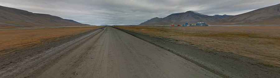
The road to the facility is mostly gravel, with some asphalt sections near Longyearbyen. It’s 19.9 km long starting off Svalbard Airport (LYR). The weather on the area is extreme. It’s a combination of an Arctic climate tempered by the North Atlantic Current. Snow typically covers the road from November to March.
The radar, at an elevation of 545m above the sea level was inaugurated on August 22, 1996. The road is pretty steep, especially the last 6.2km. The elevation gain is 514m and the average gradient is 8,29% with sections up to 10%.