How to drive to Slettnes fyr, the world’s northernmost mainland lighthouse?
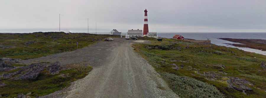
Located in Finnmark County, between the Barents Sea and the Nordkyn mountains of Norway, where Europe drops into the sea, Slettnes fyr is the world’s northernmost mainland lighthouse. It's one of the world's northernmost roads.
When was the Slettnes lighthouse built?
The lighthouse was built in 1905, partly destroyed in 1944 during World War II by German troops, and rebuilt in 1945-48. It is 39-metres (128 ft) tall.
Where is the Slettnes lighthouse?
The lighthouse is located 4 km north of the charming village of Gamvik, within the Slettnes Nature Reserve, at the far northern coast of the Nordkinn Peninsula. The road to the lighthouse will bring you to the very top of mainland Europe.
Can you drive to Slettnes lighthouse?
The road to Slettnes Lighthouse is mostly unpaved, with many holes but navigable by all passenger vehicles.
How long is the road to Slettnes lighthouse?
Starting at Gamvik, in Gamvik Municipality, the road to the lighthouse, nicknamed the road to the end of Europe, is 3.4km (2.11 miles) long. Take care with the wind.
Is Slettnes lighthouse worth it?
At the end of the road, there's a small parking lot and a café. The drive is worthwhile. There are excellent photo opportunities here. Situated on a vast coastal plain between the Barents Sea and the mountains, the building and a 12 square-kilometer area surrounding it were designated a nature reserve by the Directorate for Cultural Heritage in 1998. From the tower, there are great views of the ocean and the surrounding rugged landscape.