Driving to Kistefjell: One of the Gnarliest Roads in Norway
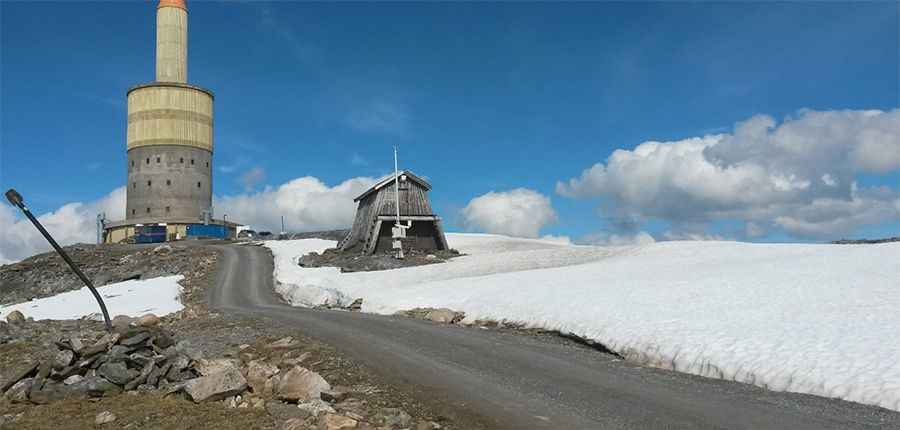
Kistefjell is a mountain peak at an elevation of 1,001m (3,284ft) above sea level, located in Troms og Finnmark county, Norway. It’s well-known due to the large TV mast that stands on top.
Where is Kistefjell?
The peak is situated between Gisundet in the west and Rossfjordvatnet in the east, in the northern part of the country.
Why is Kistefjell famous?
The summit hosts a 78-meter-high mast, known as Tårnet på Kistefjell, which transmits radio, TV, mobile signals, and internet. Originally 60 meters tall, it was extended to 78 meters in the summer of 2008 during the development of the digital terrestrial network. The Kistefjell transmitter began broadcasting FM in 1964 and TV in 1966. It is visible from the surrounding area and also serves as the location for one of the Norwegian Meteorological Institute’s measuring stations.
How long is the road to Kistefjell?
The road to the summit, built in the 1960s, is entirely unpaved and extremely steep, requiring a 4x4 vehicle. Starting from the paved Fv86, the road is 8.9 km (5.53 miles) long, with an elevation gain of 988 meters. The average gradient is 11.10%.
Is the road to Kistefjell open in winter?
The weather conditions at the summit are harsh, and driving to the top during winter poses significant risks due to ice formation and heavy precipitation. The road is usually impassable in winter and may be closed at any time without notice.
Pic: Hugo Myhre