Navigating to Longyearbyen: In the Territory of the Polar Bear
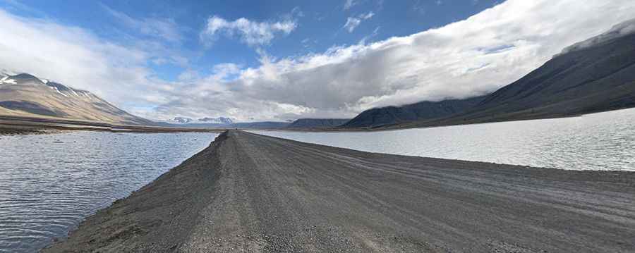
Longyearbyen Road is a very scenic drive running through a valley along the shores of Adventfjord in Norway's Svalbard archipelago.
How long is the road to Longyearbyen?
The road, located in Longyeardalen, is the main route to Svalbard's largest settlement and administrative center. It spans 27.7 km (17.21 miles) from Bjørndalshytta in the west to the EISCAT Svalbard Radar in the east, at an elevation of 548m (1,797ft) above sea level.
Is the road to Longyearbyen unpaved?
The road is mostly unpaved but is paved near Longyearbyen, an Arctic town formerly known as Longyear City until 1926. Known as the world's northernmost town, it has 2,400 residents from 53 countries. Founded by American John Munro Longyear, the town offers car rentals at the airport via Arctic Autorent or in the town center at Svalbard Auto. Early reservations are recommended due to limited availability.
Is the road to Longyearbyen worth the drive?
The route has abundant wildlife, Arctic landscapes, and remnants of old mining towns, with mountains and glaciers. Drivers should be cautious due to the region's unpredictable and harsh climate.
How’s driving in ‘The realm of the polar bear'?
Driving this road provides a look at an area known as 'The realm of the polar bear'. Encounters with polar wolves or polar bears are more likely than seeing other humans. Traveling outside Longyearbyen without a hunting rifle is not advised. Due to the presence of polar bears, being armed is crucial when leaving the settlement. Always be prepared with defensive measures against polar bears before exiting your vehicle.
Pic: Jorge Cornish