The Atlantic Road of Norway Is a Scenic Coastal Drive on the Edge of the Sea
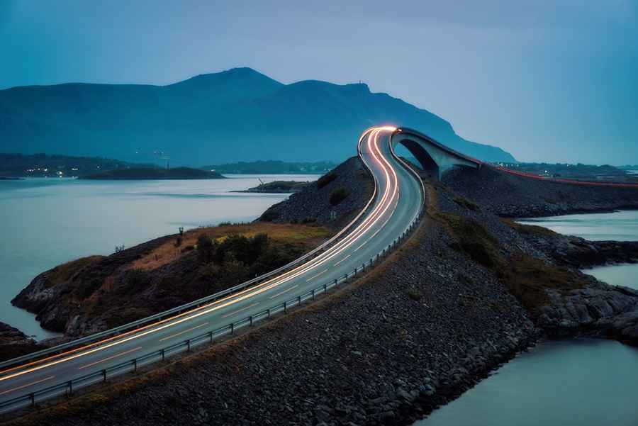
Tucked away in the midwest part of the Norwegian coastline, the coastal Atlantic Road is one of the most scenic drives in the world. Driving along this road is like teetering on the edge of the sea. The curvy road dips and arches over the brutal waves of the Norwegian Sea that often crash over the pavement during storms. This unique highway will bring you out to the very farthest point where the land ends and the ocean begins.

How long is the Atlantic Road?
The Atlantic Road is part of the 36 km (22 miles) long Atlanterhavsvegen (Roads 64/242/663/238/235). The road's roller coaster feel, curvy bridges, and phenomenal views have made it a favorite of road trippers and motorcyclists.
Where does Atlantic Ocean Road start and end?
The road starts approximately 30 kilometers southwest of Kristiansund and ends 47 kilometers north of Molde, the two main population centers in the county of Møre og Romsdal in Fjord Norway. The road includes 8 bridges with a total length of 891 meters.
Is the Atlantic Ocean Road scenic?
The Atlanterhavsveien is built on several small islands and is spanned by eight bridges and several landfills. Its 8 breathtaking (and sometimes terrifying) bridges have become one of the country’s most popular tourist attractions. It’s a very popular tourist attraction in the country. It was also designated a Cultural Heritage Site, is considered a National Tourist Route, and has been recognized as the Norwegian Construction of the Century. It's one of the famous scenic drives in Norway, known as Atlanterhavsveien in Norwegian, is just about the most scenic route one could imagine. There are several panoramic views and rest areas with facilities in bold architectural forms along the Atlantic Road. Here you can experience both nature and architecture in great interaction. Some of the viewing platforms are also popular with anglers. This road has an open sea view, which is not so common for roads along the Norwegian coast. Here the distance between the islands was so small that a road could be built across the archipelago. In addition, there are fjords and mountains inside the road. Visitors frequently use the road to go fishing for cod and other fish directly from the bridges. One of the bridges is specially designed for fishing.
Where was James Bond No Time to Die filmed?
The road has served as the set for countless car commercials and movies. This stretch of road has featured both the small and big screens numerous times since its inauguration. It was featured in the James Bond film No Time to Die (2021). Chased by Lyutsider Safin's (Rami Malek) men, James Bond (Daniel Craig) and Madeleine Swann (Léa Seydoux) face a spectacular drive along the road. Black Widow was also filmed here.
What’s the weather like in the Atlantic Road?
The weather in the area is also unpredictable and harsh, with visibility disappearing quickly, strong winds, and sudden temperature drops.
When was the Atlantic Ocean Road built?
The route was originally proposed as a railway line in the early 20th century, but the plans never managed to materialize. The construction of the road started in August 1983, and it took six years. It was opened on 7 July 1989. During its construction, the area was hit by 12 European windstorms. The road was opened on July 7th, 1989. The first ten years, drivers had to pay tolls to drive on it, but since 26th of June 1999 (at 03:00 p.m.), the road has been toll-free. The surface of the road is asphalt and had a cost of 122 million Norwegian krone.
Is the Atlantic Ocean Road scary?
The biggest fear is the wind, which often exceeds 30 miles per hour on the bridge. It has taxed the nerves of more than a few drivers. The bridge becomes a truly treacherous drive during storms. Many people have a fear that when they drive over a bridge, they'll end up in the water. If you can’t keep your eyes on the road due to the beautiful surroundings, you better just stop at one of the four viewpoints. Rain or shine, even during a storm, the road is open, which can cause an unforgettable experience.

Is driving the Atlantic Ocean Road popular?
Driving on the Atlanterhavsveien is one of the most amazing road trips in the world. The Atlantic Road meanders at the ocean’s edge, from island to island, across bridges and rock-fills. Nowadays, it is a very popular tourist attraction: a serpentine highway twisting and turning over the treacherous Norwegian Sea. Beautiful nature, bendy roads, and sometimes bad weather are a great combination that can describe this place. While it looks rather treacherous in bad weather conditions, Atlanterhavsveien is one of the most beautiful roads to travel in the world, with epic curves that can rival those of the top Scandinavian models.
Is the Atlantic Road worth visiting?
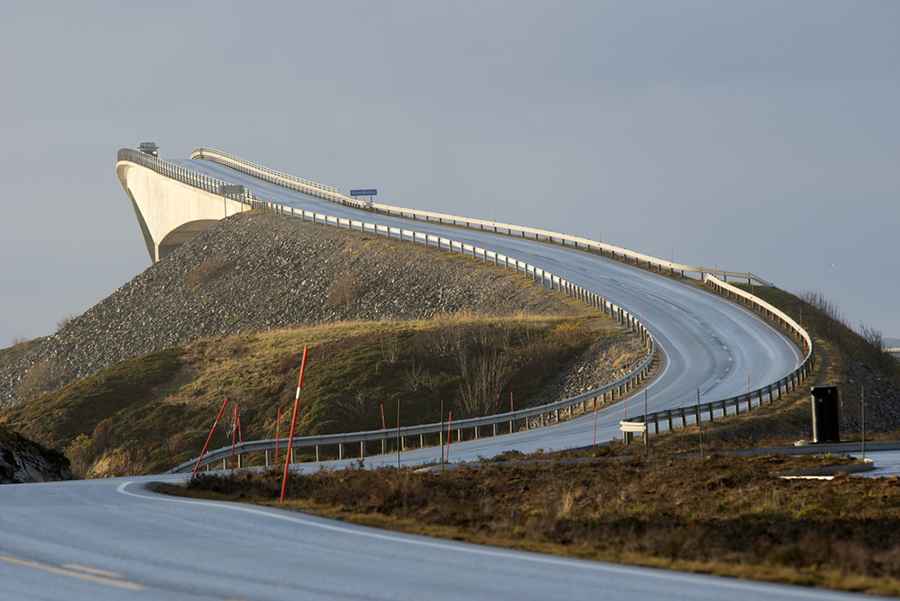
This breathtaking, scenic route is frequently listed amongst the world’s best road trips. Not a drive for the fainthearted, the Atlantic Road twists and turns through one of Norway’s most dramatic, storm-prone seas and across the awe-inspiring Storseisundet Bridge – the tallest of the road’s eight bridges and a curved architectural feat that, when viewed from certain angles, appears to drop off straight into the sea. Belly-flips and bridges make up this high-octane drive along the Norwegian coastline. The overpass dips during this journey can be experienced between Kristiansund and Molde, and regular vicious storms in the area intensify the ride. If “technical” driving does nothing for you, get ready to see unusual birds flying overhead, while seals and whales swim off the coastline. Plus, at dusk there’s a wickedly orange sunset. It’s one of the best coastal drives in the world.
Technical facts about the Atlantic Road:
Overall length: 8274 meters
Width: 6.5 meters
Maximum gradient: 8%
Cost: 122 million Norwegian Kroner (1989)
Financing: 50% of highway funds, 25% employment assets and share capital, 25% toll Opening: 7 July 1989
Vevang Stream bridge: 119 meters long, 10 meters high
Hulvågen bridges (3 bridges): 293 meters long, 4 meters high
Storseisundet bridge: 260 meters long, 23 meters high
Geitøysundet bridge: 52 meters long, 6 meters high
Store Lauvøysund bridge: 52 meters long, 3 meters high
Little Lauvøysund bridge: 115 meters long, 7 meters high
Image credit: Depositphotos