National Tourist Route Valdresflye is a scenic drive in Norway
National Tourist Route Valdresflye is a very scenic mountain road in Innlandet county, in Norway. It's one of the famous scenic drives in Norway.
How long is the National Tourist Route Valdresflye?
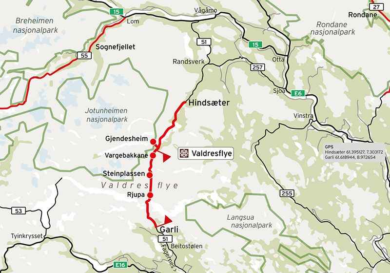
The road, called County Road 51 (Fylkesvei 51), is 49km (30.44 miles) long and runs from Garli (near Beitostølen) to Besstrondsæter in Vågå.
How is the National Tourist Route Valdresflye?
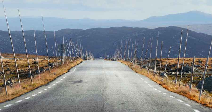
Tucked away in the eastern part of the country, the road is totally paved. It’s a little bit narrow at times but mostly fine, running across undulating terrain.
Is the National Tourist Route Valdresflye open?
Set high on the eastern part of the Jotunheimen mountains, the road tops out by the Valdresflye, a mountain plateau at 1.393m (4,570ft) above sea level. It's one of the highest roads of the country. The road opens from early May and normally well into the month of November. The weather may change rapidly at the mountain plateau.
Is the National Tourist Route Valdresflye worth it?
The road offers stunning views of the most striking contrasts of the Norwegian landscape. On the plateau the route has views towards Jotunheimen National Park, while further down the road passes through cultivated landscape with mountain pastures. The summit is an extremely popular starting point for magnificent spring ski trips across the level mountain plateau to the east or up toward the Jotunheimen peaks. The road provides endless vistas as it hovers free and light above the mountain plateau, with excellent views towards the Jotunheimen National Park, from which it seems to swoop into the Jotunheimen massif like the beginning of an endless journey. To the north, you can catch a view of the Jotunheimen National Park, where the mountains are steeper and wilder than to the south, where the landscape widens into serene, rolling hills.
Facts:
Roads: Road 51
Length: 49km
Highest elevation: 1.393m
Ferries: 0
Winter notice: Parts of the route are closed during the winter between Garli and Maurvangen but the stretch between Hindsæter and Gjendesheim is open.
Other: Keep an eye open for domestic reindeer.
Pic&map: https://www.nasjonaleturistveger.no/en/routes/valdresflye?gallery=Valdresflye%20-%20Bildegalleri