How to drive the scenic Andoya National Tourist Route in Norway?
Andøya National Tourist Route is a very scenic drive running along the west side of Andøya Island, in the Vesterålen archipelago of Nordland county, in Norway. It's one of the famous scenic drives in Norway.
Where is Andøya National Tourist Route?
The route is located in the northern part of the country. It’s said to be one of the most remote of Norway's National Scenic Routes. In the summer, you can drive under the midnight sun.
Is Andøya National Tourist Route paved?
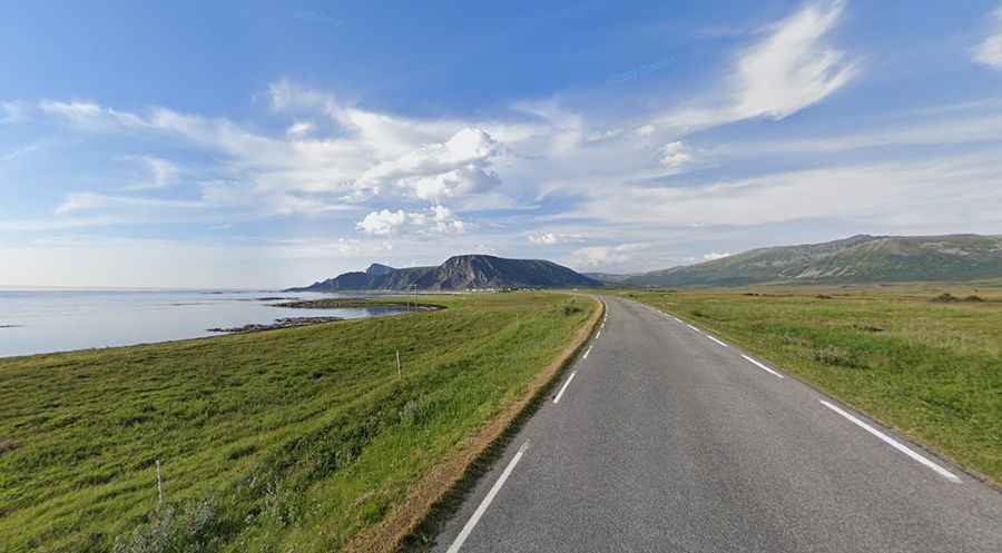
National Tourist Route Andøya is totally paved and comprises Norway roads 974, 976, and 82. The route winds its way through staggering scenery. It’s usually open all year round. Pay attention to the wind.
How long is Andøya National Tourist Route?
The drive is 58km (36 miles) long and runs from Bjørnskinn in the south to Andenes at the northernmost tip of the island. The route connects to National Tourist Route Senja by ferry in summers.
Is Andøya National Tourist Route worth it?
Tucked away in the Arctic Circle, the drive offers stunning views on the west coast of Andøya Island. The region has been shaped by the rough Norwegian Sea. Along the road, it’s possible to see seals, whales, and eagles from your car window and offers a magnificent view of white sandy beaches, craggy peaks, and the wide expanse of the ocean. There are many small towns on the island, so you will have many options to find a stay. The military Andøya Air Station is located next to Andenes.
Facts:
Roads: Road 974/976/82
Length: 58km
Highest elevation: 65m asl
Ferries: 0
Winter notice: Open to traffic throughout the year. May be closed for short periods in winter when the weather is bad.