How to drive the Honningsvåg Tunnel, the northernmost public tunnel in the world
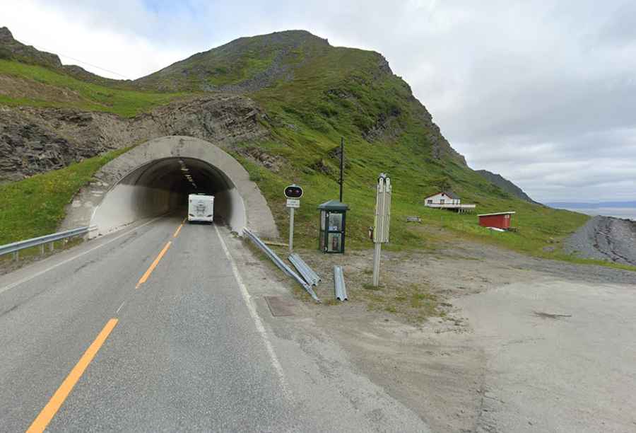
The Honningsvåg Tunnel (Honningsvågtunnelen) is a road tunnel at the northern tip of Norway, located in the Nordkapp Municipality of Finnmark county. The 4,443-meter passage through the Honningsvågfjellet mountain is the northernmost public road tunnel in the world.
| Road facts: Honningsvåg Tunnel | |
|---|---|
| Location | Magerøya, Nordkapp (Norway) |
| Length | 4,443 m (14,577 ft) |
| Width | 9 m (30 ft) |
| Road | European route E69 |
Where is the Honningsvåg Tunnel?
The tunnel is located on the island of Magerøya, slightly north of the undersea North Cape Tunnel. It carries the E69 highway through the Honningsvågfjellet mountain, west of the town of Honningsvåg. The 9-meter wide tube features two lanes and serves as a link for traffic heading toward the North Cape.
When was the Honningsvåg Tunnel built?
Construction was completed simultaneously with the North Cape Tunnel, and both were opened on 15 June 1999. The project was designed to replace ferry links and provide a permanent road connection from mainland Norway to the North Cape. The 4,443-meter tunnel was blasted through hard rock to cross the mountain massif.
What are the driving hazards in the Honningsvåg Tunnel?
Due to the extreme arctic latitude, the tunnel is equipped with automatic thermal doors at both entrances. These gates remain closed during the winter to block freezing air and prevent water leaks from turning the road surface into ice. The doors open automatically as a vehicle approaches. During the summer, when traffic is denser, the doors stay open permanently.
How long is the road to Honningsvåg Tunnel?
The tunnel is part of the 129 km (80 mi) long European route E69, the world’s northernmost highway. The road runs from Olderfjord to Nordkapp. Any vehicle driving to the northernmost point of Europe must pass through this mountain tunnel after clearing the subsea section from the mainland.