How to drive the unpaved road to Col Rodella?
Col Rodella is a high mountain peak at an elevation of 2.462m (8,077ft) above sea level, located in the Autonomous Province of Trento, in Italy.
Where is Col Rodella?
The peak is located in the Trentino-Alto Adige/Südtirol region, in the northern part of the country, within the Val di Fassa.
What’s at the summit of Col Rodella?
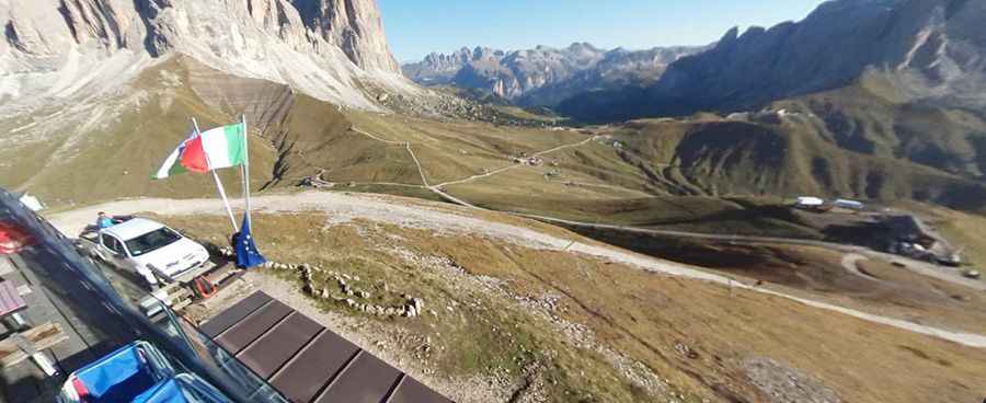
At the summit there is a mountain hut and a few communication towers. There’s been a refuge up here for over a hundred years.
Is the road to Col Rodella unpaved?
The road to the summit is a service road for the chairlifts. It’s totally unpaved, rocky and very steep. 4x4 vehicles only. It’s closed to private vehicles.
How long is the road to Col Rodella?
Starting from the paved Strada Statale 242 (SS242), the road to the summit is 2.7 km long. Over this distance, the elevation gain is 241 m and the average gradient is 8.92%.
Is the road to Col Rodella open year-round?
Set high in the Fassa Dolomites range, the road is totally blocked by snow in winters.
Pic: Vašek Zítka