How to drive the unpaved road to Pian della Nana in Trentino?
Pian della Nana is a large karst amphitheatre at an elevation of 2.094m (6,870ft) above sea level, located in Trentino, in Italy.
Where is Pian della Nana?
The mountain plateau is located in the region Trentino-Alto Adige/Südtirol, in the northern part of the country, at the beginning of the Val Nana, in the heart of the Adamello Brenta Natural Park. At the summit there is a mountain refuge known as Malga Tassulla.
Is the road to Pian della Nana unpaved?
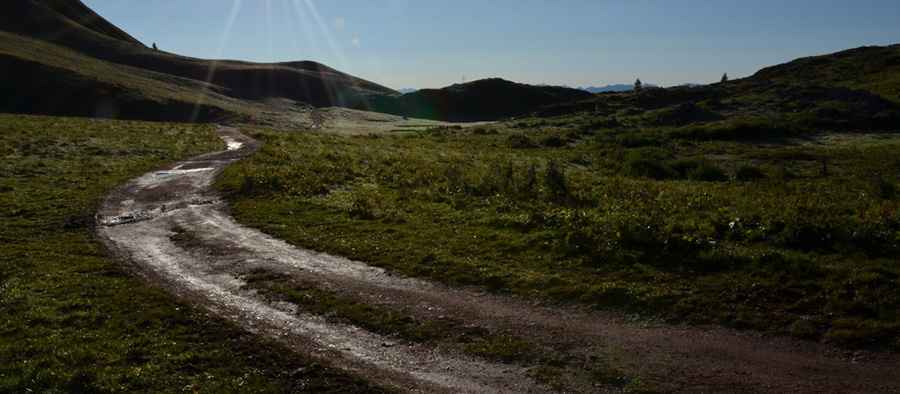
The road to the summit comprises paved parts (near the start) and unpaved sections (near its end). It’s pretty rough and steep, so a 4wd vehicle is required though the final part it’s closed to private vehicles. Along the way you can see the Val di Tovel with the Lago di Tovel below and the peaks of the northern Brenta group.
How long is the road to Pian della Nana?
Starting from the village of Dres (SS43 Road), the ascent is 19.4 km long. Over this distance the elevation gain is 1.428 meters. The average gradient is 7.36%.
Is the road to Pian della Nana open year-round?
Set high in the wildest part of the Brenta Dolomites, the road is blocked by the snow in winters.
Pic: Tarcisio Rizzardi