How to get by car to Col de Valvacin in the Dolomites?
Col de Valvacin is a high mountain peak at an elevation of 2,360m (7,742ft) above sea level, located in the Province of Trento, in Italy.
Where is Col de Valvacin?
The peak is located in the Trentino-Alto Adige/Südtirol region, in the northern part of the country. It’s situated in the heart of the Dolomites, overlooking the Val di Fassa. It stands above the town of Pozza di Fassa and is part of the Buffaure ski area, offering views of the Marmolada and the Catinaccio massifs.
🇮🇹 Col de Valvacin / Rifugio El Zedron Data
| Elevation | 2,360m (7,742ft) |
| Location | Val di Fassa (Trentino) |
| Distance | 8.5 km (from Pozza) |
| Destination | Rifugio El Zedron |
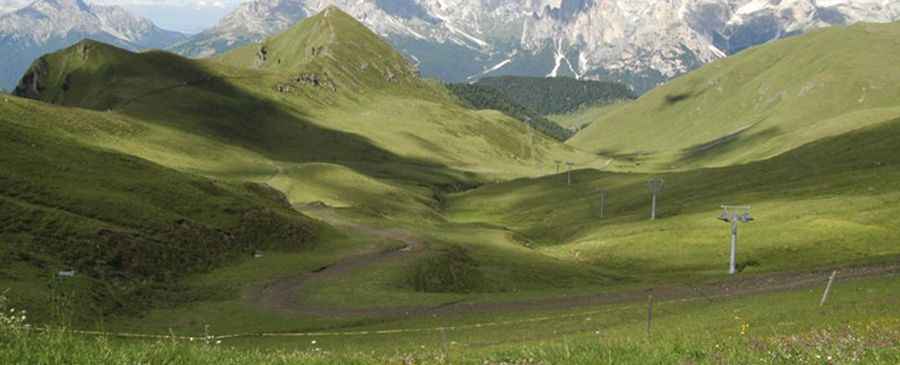
Is the road to Col de Valvacin paved?
The road to the summit is completely unpaved. It is a steep service track primarily used for the maintenance of ski facilities and mountain refuges. The surface consists of loose gravel and rocks, requiring a high-clearance 4x4 vehicle. The final section leads directly to the Rifugio El Zedron and the arrival station of the chairlift.
How long is the road to Col de Valvacin?
Starting from Pozza di Fassa, the ascent is approximately 8.5km (5.2 miles) long. Over this distance, the elevation gain is 1,017 m and the average gradient is 11.96%. The route follows the tracks through the Buffaure basin, passing by Rifugio Baita Cuz before reaching the summit ridge. The climb is constant and includes several steep ramps with gradients exceeding 15% in some sections.
When is the road to Col de Valvacin open?
Due to its altitude and use as a ski slope during the winter, the road is only accessible to vehicles during the summer season, typically from mid-June to early October. The track is impassable for cars during the rest of the year due to snow cover.
What is at the summit of Col de Valvacin?
The summit area is a hub for high-altitude logistics. It hosts the Rifugio El Zedron, a mountain restaurant, and the upper station of the Buffaure-Col de Valvacin chairlift. It is also a frequent starting point for paragliders and hikers heading towards the San Nicolò valley.
Pic: Fabio Poggi