Driving the steep 4x4 road to the Palasinaz Lakes in Aosta
The Palasinaz Lakes (also known as the 7 Lakes of Palasinaz, including Literan, Battaglia, Verde, Potcha, Chaudière, Lungo, and Bringuets) are a group of alpine basins at an elevation of 2,445 meters (8,021 ft) above sea level, located in the Aosta Valley region of northwestern Italy. The lakes are accessed via an unpaved mountain track that climbs from the Val d'Ayas above the town of Brusson.
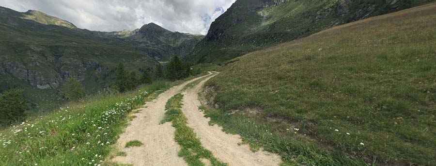
| Road facts: Palasinaz Lakes | |
|---|---|
| Location | Brusson, Aosta Valley (Italy) |
| Elevation | 2,445 m (8,021 ft) |
| Length | 10.7 km (6.6 miles) from Brusson |
| Elevation Gain | 1,102 m (3,615 ft) |
| Average Gradient | 10.29% |
| Surface | Unpaved (Dirt and loose stone) |
Where is the road to the Palasinaz Lakes?
The track is located in the Pennine Alps, above the municipality of Brusson in the Val d'Ayas. The unpaved route climbs the slopes past Estoul and Col de Joux toward the high basin of Palasinaz.
How steep is the drive to the Palasinaz Lakes?
Starting from Brusson, the ascent spans 10.7 kilometers (6.6 miles) with an elevation gain of 1,102 meters, averaging a 10.29% gradient. The route is unpaved, consisting of hard-packed dirt, loose rocks, and deep water runoff channels across the track. Four-wheel-drive vehicles with high ground clearance are required to navigate the steep ramps and ruts without striking the undercarriage.
What hazards exist on the Palasinaz Lakes track?
The single-lane mountain track lacks guardrails along exposed alpine drop-offs. Water runoff creates deep transversal grooves across the dirt surface, reducing tire traction on the hairpins. On the 1,102-meter descent back toward Brusson, low-range gears are necessary to use engine braking and prevent brake pads from overheating.
Are there access restrictions on the Palasinaz track?
Yes. Motorized access on the upper track leading directly to the lakes is regulated by local forestry authorities and generally restricted to authorized personnel, farm operators, and local property owners. Heavy snow covers the route at 2,445 meters from late autumn through June.
Pic: Carlo Galinetto