How to drive the steep road to Mont Fraitève in Piedmont?
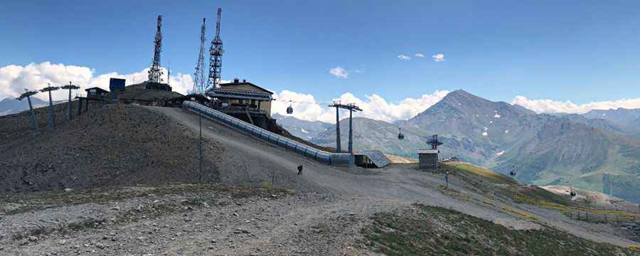
Mont Fraitève is a mountain peak at an elevation of 2,687 meters (8,815 ft) above sea level, located in the Piedmont region of northwest Italy, near the French border. The track leading to the summit is an unpaved service road used for the maintenance of the Sestriere ski resort infrastructure and the radio communication towers at the crest.
| Road facts: Mont Fraitève | |
|---|---|
| Location | Piedmont, Italy |
| Elevation | 2,687 m (8,815 ft) |
| Length | 5 km (3.1 miles) from Sestriere |
| Max Gradient | 20% |
| Surface | Unpaved / Shifting shale and loose gravel |
How long is the road to the summit of Mont Fraitève?
The climb starts from the ski resort town of Sestriere and covers a distance of 5 km (3.1 miles) to the top of the peak. This short track gains elevation rapidly via the service trails of the Via Lattea ski area, ranking it among the highest roads of Italy. The lower kilometers consist of wide gravel paths, but the lane narrows as it nears the upper ridges, turning into a single-vehicle track with no passing options.
What is the track surface of the Mont Fraitève road like?
The surface is entirely unpaved and composed of loose gravel, crushed rocks, and shifting shale fragments. On the upper sections approaching the 2,687-meter mark, the continuous 20% gradients combine with the loose debris to cause traction loss, requiring a heavy-duty 4x4 system with a low-range transfer case to maintain forward momentum. The path has no steel guardrails, concrete barriers, or stone walls, leaving the outer tire tracks completely exposed to the steep, scree-covered mountain slopes.
When does winter snow close the Mont Fraitève track?
The high-altitude track is completely blocked by heavy snowfall and deep drifts from October until late August. During the winter season, the route disappears entirely as it is integrated into the active ski pistes of Sestriere and Sauze d'Oulx, making motorized transit impossible. During the brief summer opening, high-altitude mountain winds are constant along the exposed ridge lines, and sudden thunderstorms can quickly erode the dirt foundation, cutting deep ruts across the path.
What are the hazards near the summit weather station?
The final push to the crest leads directly to the mountain weather station and telecommunication antennas. Crawling up the sustained 20% inclines at slow speeds limits the airflow through the radiator, causing engine temperatures to rise rapidly in the thinner air. The terminal sector of the track offers minimal room for maneuvering, forcing long-wheelbase vehicles or vans to perform multi-point turns right on the unprotected cliff edges to head back down the mountain.
Pic: Mario Pepita