The wild road to Testa Grigia in the Alps
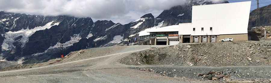
Testa Grigia is an international high mountain peak at an elevation of 3.471m (11,387ft) above sea level, located on the border of Switzerland and Italy. It’s one of the highest roads of Europe.
Where is Testa Grigia?
Located in the eastern Pennine Alps, the peak sits on the border of southern Switzerland’s Valais canton and the Valle d'Aosta region of northwest Italy, above the Theodul Pass. At the peak, you'll find Rifugio Guide del Cervino, a mountain refuge.
How hard is the road to Testa Grigia?
The road to the summit, a chairlift access trail, is totally unpaved and very steep, hitting a 30% of maximum gradient through some of the ramps. Consisting of loose stones, the trail becomes rockier towards the top. It's one of the highest roads of the country.
Is the road to Testa Grigia open in winter?
The road is open for a brief period during the summer only, typically around the end of August. Expect strong winds, which are common throughout the year. Snow is possible even in summer, and winter temperatures can be extremely cold.
Pic: Francis Petit-Colin