How difficult is the 4x4 road to Lago Gabiet in the Aosta Valley?
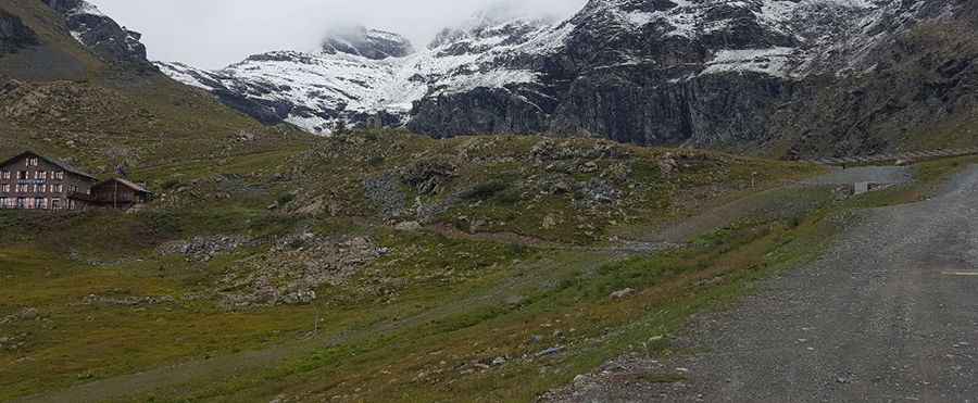
Lago Gabiet is a high mountain reservoir reaching an elevation of 2,384m (7,821ft) above sea level in the Gressoney Valley, part of the Aosta Valley region in Northern Italy. Tucked into the foothills of the Monte Rosa massif, the road to this alpine lake is a demanding unpaved track that serves the local ski infrastructure. This is a journey through a high-altitude landscape where the steepness of the ramps and the loose rocky surface require a capable 4x4 vehicle and a driver comfortable with narrow, unprotected mountain ledges.
| Road facts: Lago Gabiet | |
|---|---|
| Location | Gressoney-La-Trinité, Aosta Valley (Italy) |
| Elevation | 2,384 m (7,821 ft) |
| Length | 4.7 km (2.9 miles) from Staffal |
| Surface | Unpaved / Gravel / Service Track |
| Vehicle Required | High-clearance 4x4 |
How long is the unpaved climb from Staffal to Lago Gabiet?
The drive starts from the village of Staffal, at the end of the Gressoney-La-Trinité valley, and covers 4.7 km (2.9 miles) to reach the lake. While the distance is short, the elevation gain is concentrated in several brutal ramps that wind up the mountain face. The road is entirely unpaved, consisting of crushed rock and dirt that has been packed down by heavy service vehicles. As you climb, you are rewarded with a massive panorama of the Monte Rosa peaks, including the Breithorn, Castore, Polluce, and Lyskamm, but the narrowness of the track means you must keep your eyes on the ruts rather than the scenery.
What are the main hazards of driving to Lago Gabiet?
The primary hazard is the steepness of the access track. Because this is a service road for the ski resort, the gradients are far steeper than those of a standard mountain pass, often requiring low-range gearing to maintain traction on the loose gravel. The road is narrow and features several sharp hairpin turns where the outer edge is completely unprotected. If you meet another vehicle coming down from the lake, reversing on these steep inclines can be extremely "hairy" due to the lack of visibility and the unstable nature of the shoulder. A high-clearance 4x4 is essential to avoid scraping your undercarriage on the large rocks that often litter the path after a heavy rain.
Is the road to Lago Gabiet open year-round?
Like most roads at this altitude in the Aosta Valley, the track to Lago Gabiet is strictly seasonal. It is usually impassable from October to June due to heavy snow accumulation and avalanche risks. Even during the summer months, the road can be closed due to maintenance or severe weather conditions. Sudden thunderstorms in the Alps can turn the dry dirt into a slick, muddy slurry in minutes, making the steep descent back to Staffal a dangerous test for your brakes. Always check the local weather forecast before attempting the climb, as a sudden drop in temperature can bring ice to the higher sections of the road even in July.
What mechanical preparation is needed for the Gressoney highlands?
Before leaving Staffal, ensure your vehicle’s braking system is in perfect condition. The descent from 2,384 meters is relentless, and you must use engine braking to prevent your pads from overheating. Your tires should have deep tread to handle the loose shale and sharp rocks of the upper sections. Because the climb is short but very steep, your cooling system will be under significant stress; check your coolant levels and ensures your radiator is clear of debris. In this part of the Italian Alps, there is no roadside assistance, so carrying basic recovery gear and a spare tire is the only way to ensure your trip to Lago Gabiet doesn't end with a costly tow back down the valley.
Pic: Francesca Belfiori