Col Margherita: Driving the steep 20% ski-station road
Col Margherita is a high mountain peak at an elevation of 2,524m (8,280ft) above sea level, situated on the border between Trentino-South Tyrol and Veneto in the Italian Dolomites. Logistically, the route is a rugged ski-station service road that traverses the Bocche chain. Technically, the track is defined by its extreme vertical gain and a surface composed of loose volcanic rock and porphyry.
| Road facts: Col Margherita | |
|---|---|
| Location | Dolomites (Trentino/Veneto), Italy |
| Elevation | 2,524 m (8,280 ft) |
| Average Gradient | 14.97% |
| Max Gradient | 20% |
How to drive the steep service road to Col Margherita?
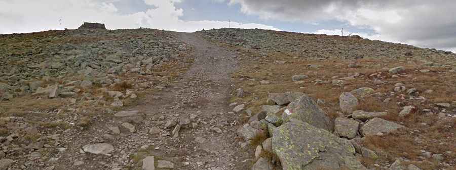
The ascent begins at Passo San Pellegrino and covers 3.9 km with a massive elevation gain of 584 meters. Technically, this results in a punishing average gradient of 14.97%, with several ramps hitting the 20% mark. Logistically, the road is a chairlift access trail consisting of loose stones and shale. In the upper sections, the terrain becomes even more fractured and rocky. A high-clearance 4x4 vehicle with a low-range gearbox is mandatory to maintain constant torque and prevent wheel spin on the unstable surface.
What are the weather hazards on the Col Margherita road?
Due to its high elevation and total exposure, the track to Col Margherita is subject to extreme meteorological conditions. Technically, the peak is a natural barrier where high-velocity winds blow year-round. Logistically, the driving window is extremely narrow, usually restricted to a few weeks in late August when the snow has fully receded. Sudden weather shifts can drop temperatures to near freezing even in summer, increasing the risk of ice on the rock slabs. Any mechanical intervention at 2,500m is complicated by these rapid atmospheric changes and the lack of shelter along the 3.9 km climb.
What are the technical requirements for the Bocche chain ascent?
Driving on the Bocche chain ridge requires specific mechanical preparation. Technically, the sustained 20% incline puts extreme stress on the vehicle's cooling system and transmission. Logistically, the descent toward the San Pellegrino valley is as hazardous as the climb; the loose porphyry stones act like ball bearings under the tires. Engine braking must be prioritized to avoid overheating the brake fluid. Furthermore, the track is shared with maintenance machinery for the ski station, meaning drivers must be prepared for narrow passing points on steep, unprotected shoulders where the roadbed is often eroded by summer meltwater.