How to drive to the summit of Plan Maison?
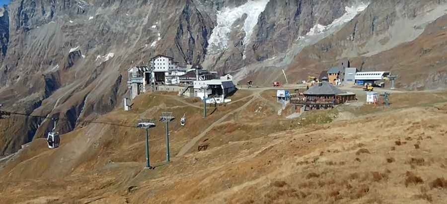
Plan Maison is a mountain peak at an elevation of 2.552m (8,372ft) above sea level, located in the Aosta Valley region of Italy. It’s one of the highest roads in the country.
Where is Plan Maison?
Tucked away in the north-western part of the country, there are some restaurants, hotels and shops at the summit.
Is the road to Plan Maison unpaved?
The road to the summit is totally unpaved. It’s a chairlift access trail. 4x4 vehicles only, as the road comprises loose gravel, rocks and very steep parts, hitting a 20% of maximum gradient through some of the ramps.
Is the road to Plan Maison open in winters?
Set high in the Alps, the road is totally impassable in winters. High winds blow here all year long.
How long is the road to Plan Maison?
Starting from Breuil-Cervinia, the road to the summit is 4.2 km long. Over this distance, the elevation gain is 536 m and the average gradient is 12.76%.
Pic: Mauro Scaglia