A Memorable Road Trip to Platigliole Pass in the Alps
Passo delle Platigliole is a high mountain pass at an elevation of 2,908m (9,540ft) above sea level, located in the province of Sondrio, in Italy. It's one of the highest roads in Europe.
Where is Platigliole Pass?
The pass is located in the Lombardy region, in the northern part of the country, near the Swiss border.
Where Does the Road Through Platigliole Pass Start and End?
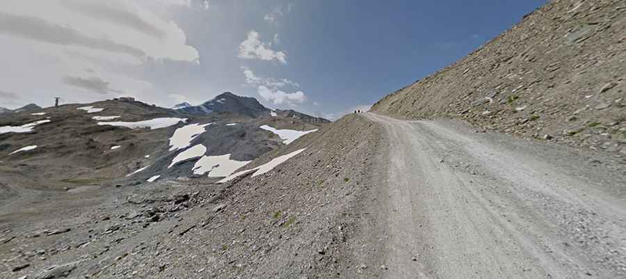
The road to the summit is totally unpaved. It runs north-south from Stelvio Pass to Rifugio Piccolo Pirovano. It starts south from the Bormio side of the pass height (the other at the exact top ends soon), hidden at the parking area at the cable car station.
How Long is the Road Through Platigliole Pass?
The road is 1.93km (1.2 mi) long. Running through a lunar landscape, a 4x4 vehicle is required. Apart from two short bad sections with 25% gradient, you can otherwise ride this road on the way up to 3,018m (9,901 ft) above sea level, where it ends. The road ends at this point where the snow, skiers, and glacier start. There are 3 other hotels in the zone.
Is Platigliole Pass Open in Winter?
Set high in the Alps, the area becomes very windy and accordingly cold. At this elevation, it’s totally impassable in winter. It's one of the highest roads in the country. Along the road, you get some nice views over the Stelvio Pass. The runway conditions vary from flat passages to other hardly rideable steep sections.