Monte Chaberton: Get behind the wheels for one of the planet’s most challenging trips
Monte Chaberton is a high mountain peak at an elevation of 3.131m (10,272ft) above sea level, located in the department of Hautes-Alpes, in France. The summit features a fortress with remnants of a WWI & WWII artillery battery. It's one of the highest roads in Europe.
Where is Monte Chaberton?
The peak is located in the Provence-Alpes-Côte d'Azur region in the southeastern part of France, near the Italian border. Until 1947, Mont Chaberton was in Italy, located in the municipality of Cesana Torinese.
What’s on the summit of Monte Chaberton?
The summit features Fort du Chaberton, a military fortress also called Fort des Nuages. Built between 1900 and 1914, the summit had to be mined to level it and thus lower its height by 6 meters. It took no less than 300 civilian workers and minor engineers to build this technical and human feat, made up of 8 turrets. These form the visible part of the building, the whole of which is mainly underground. The fort was dubbed the "Fort of the Clouds" and mounted eight 149mm guns in individual masonry turrets, which were often hidden in the clouds.
When was the road to Monte Chaberton built?
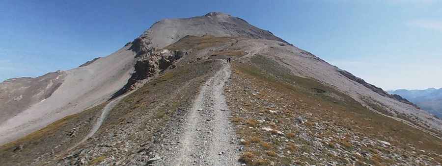
The road to the summit is called Strada militare dello Chaberton. This carriage road, also known as Strada Militare di Val Morino, was built between 1896 and 1898 by Italian troops that built an artillery battery on the summit that pointed towards France, in particular at the town of Briançon, and the pass to Italy over the Col de Montgenèvre.
How long is the road to Monte Chaberton?
This old military road, with a length of 12.3km (7.64 miles), used to be the highest unpaved road of the Alps. However, the road is no longer continuously drivable. This road to the Battery Chaberton starts in the village of Fénils in the Italian Susa Valley. Nowadays, the road is extremely poor, and at an altitude of 2,300 meters, the way is almost no longer passable. After pushing your bike up to the Colle delle Chaberton, at 2,674m above sea level, you can likely ride your bike on a 17% slope to the fort on top of Mont Chaberton.
Is the road to Monte Chaberton open to vehicles?
Located in the French Alps in the group known as the Massif des Cerces, the road also called 'Fenils-Chaberton,' is now totally closed to any motorized vehicle. It's drivable, in parts, only by authorized cars since 1987. It's one of the highest roads in the country. To reach the top, the trail starts paved, near the Strada Statale 24 del Monginevro (SS24) in Fenils. After the village, the road becomes unpaved but in good condition to Grange Pra Claud. From here it is totally closed to motor vehicles. At this point, the trail is about a meter wide. In many places, the debris has almost completely covered and the walls and supporting structures are largely collapsed.
Pic: Sandro Cadeddu