Driving the service road to Lago Rotondo: A brutal climb in the Bergamo Alps
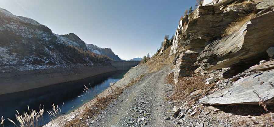
The road to Lago Rotondo (leading toward Rifugio Fratelli Calvi) is an unpaved mountain track reaching an elevation of 2,007 meters (6,584 ft) above sea level, located in the Bergamo Alps, Lombardy, Italy. Starting from the village of Carona in the upper Brembana Valley, the route serves as the service access to the Fregabolgia dam.
| Road facts: Lago Rotondo / Rifugio Calvi | |
|---|---|
| Location | Carona, Bergamo, Lombardy (Italy) |
| Elevation | 2,007 m (6,584 ft) |
| Length | 7.9 km (4.9 miles) from Carona |
| Elevation Gain | 879 m (2,883 ft) |
| Average Gradient | 11.12% |
| Surface | Gravel, rough stones, and concrete ramps |
| Access Status | Restricted to authorized vehicles beyond lower sector |
Where is the road to Lago Rotondo located?
The track starts at Carona in the province of Bergamo. It climbs the mountain valley past Lago del Prato and Lago Fregabolgia before terminating near Lago Rotondo and Rifugio Fratelli Calvi.
How steep is the climb to Lago Rotondo?
The 7.9-kilometer route gains 879 vertical meters from Carona, averaging an 11.12% gradient. Steep ramps feature reinforced concrete strips for traction, while intermediate sections consist of loose gravel, large stones, and water channels. High-clearance four-wheel-drive vehicles are required due to deep ruts and rock steps along the single-lane track.
What hazards exist on the Fregabolgia dam service track?
The single-lane road lacks guardrails along exposed drop-offs into the Brembana Valley. Meeting authorized service vehicles or local agricultural trucks requires stopping or reversing to narrow turnouts carved into the slope. On the 11% descent back to Carona, low-range gears are necessary to use engine braking and prevent brake pads from overheating on the concrete and stone surface.
Are there permit or traffic restrictions on the Lago Rotondo track?
Yes. Private motorized traffic is prohibited beyond the lower section near Carona. Access is restricted to authorized dam personnel, local property owners, and mountain hut operators. Hikers and mountain bikers share the narrow track throughout the summer season.