How to drive the unpaved road to Alpe Trela?
Alpe Trela is a high mountain pass at an elevation of 2.181m (7,155ft) above sea level, located in the Province of Sondrio, in Italy.
Where is Alpe Trela?
The pass is located in the Lombardy region, in the northern part of the country, near the border with Switzerland.
What’s at Alpe Trela?
Tucked away in the Stelvio National Park, at the summit there’s a farmstay known as Malga Alpe Trela.
Is the road to Alpe Trela unpaved?
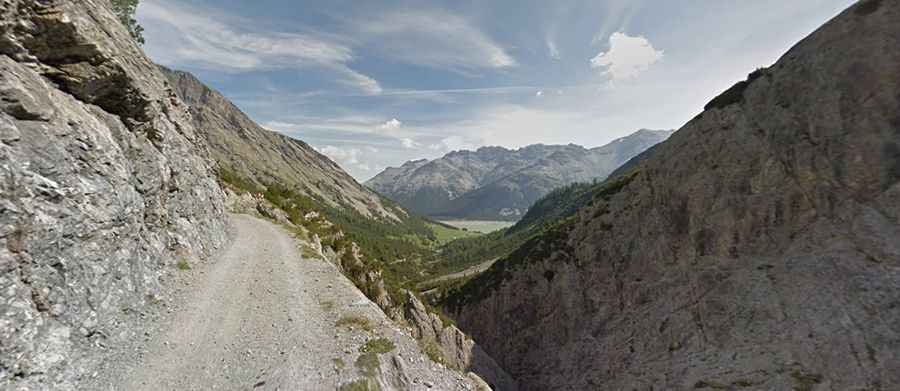
The road to the summit is totally unpaved, with loose rocks. It comprises narrow sections, dangerous drops and brutally steep parts near its end. A 4x4 vehicle is required though it’s closed to private vehicles.
How long is the road to Alpe Trela?
Starting from Passo di Fraele, the road to the summit is 5.1 km long. Over this distance, the elevation gain is 218m and the average gradient is 4.27%.
Is the road to Alpe Trela open year-round?
Set high in the Alps, the road is usually impassable in winters.