How to drive the military road to Val Forcola
Val Forcola is a high mountain valley at an elevation of 2.126m (6,975ft) above sea level, located in the Province of Sondrio, in Italy.
Where is Val Forcola?
The valley is located in the Italian region Lombardy, in the northern part of the country.
Is the road to Val Forcola paved?
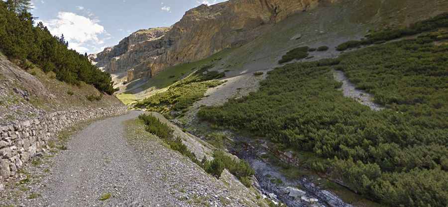
The road to the summit has two distinct sections. The first stretch up to Lago Artificiale di Cancano runs through Torri di Fraele and is mostly paved, though it remains narrow and tightly winding. The second part changes to a terrifying and rough old military track that causes severe vertigo for drivers unused to high-altitude routes. The track shrinks to the strict width of a single vehicle, forcing tires to roll right along a completely raw, crumbling outer edge with absolutely zero guardrails, walls, or safety barriers. The drop into the deep canyon is vertical and immediate. The surface turns into a mix of deteriorated concrete patches, loose gray gravel, and sliding stones that continuously threaten tire traction, while the inner side is pinned against an unstable, rocky scree slope that drops debris directly onto the narrow lane. It features a high risk of rock slides.
How long is the road to Val Forcola?
Starting from Sant'Antonio, the road to the summit is 11.8 km long. Over this distance, the elevation gain is 558 m and the average gradient is 4.72%.