Driving the breathtaking road to Bellecombe is not a piece of cake
Bellecombe is a high mountain peak at an elevation of 2,602m (8,536ft) above sea level, located in the Alps on the French-Italian border. It’s one of the highest roads in the country.
Where is Bellecombe?
The peak links Savoie (in southeastern France) and Aosta Valley (in northwestern Italy). It’s located to the south of the Mont Blanc Massif.
Is the road to Bellecombe unpaved?
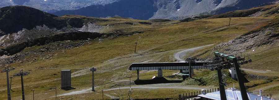
Running parallel to Little Saint-Bernard Pass (Col du Petit-Saint-Bernard/Colle del Piccolo San Bernardo), the road to the summit is entirely unpaved. It’s an access road to the Bellecombe ski lift.
How long is the road to Bellecombe?
It’s about 12km (7.45 miles) long, running from D1090 Road in France to Strada Statale 26 (SS26) in Italy. A 4x4 vehicle is required.
Is the road to Bellecombe open?
Set high in the Alps, the road to the summit is totally impassable in winter.
Pic: Stefano Benedetti