Rifugio Pulpito: A brutal climb in the heart of the Ortler Range
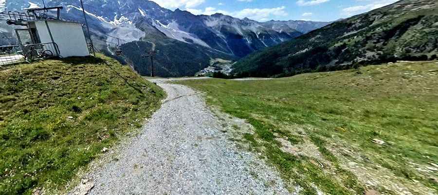
Rifugio Pulpito (also known as Kanzel-Hütte) is a mountain refuge at an elevation of 2,354 meters (7,723 ft) above sea level, located in the Ortler Alps within South Tyrol, Italy. Situated in Stelvio National Park above the village of Solda (Sulden), the unpaved track serves as a service route for the ski area and high-altitude hut.
| Road facts: Rifugio Pulpito (Kanzel-Hütte) | |
|---|---|
| Location | Solda (Sulden), South Tyrol (Italy) |
| Elevation | 2,354 m (7,723 ft) |
| Length | 3.3 km (2.05 miles) from Solda |
| Elevation Gain | 458 m (1,502 ft) |
| Average Gradient | 13.87% |
| Surface | Unpaved (Gravel, dirt, and loose rock) |
| Access Restrictions | Restricted (Authorized service vehicles only) |
Where is the road to Rifugio Pulpito located?
The climb begins in the valley village of Solda (Sulden) within Stelvio National Park. The 3.3-kilometer route gains 458 vertical meters as it climbs the steep eastern slopes of the Sulden valley toward the refuge at 2,354 meters elevation.
How steep is the drive to Rifugio Pulpito?
Starting from Solda, the track averages an extreme 13.87% gradient over 3.3 kilometers, with internal ramps exceeding 18%. The surface is entirely unpaved, made of loose gravel, dirt, and stones, with continuous tight switchbacks cutting across steep mountain terrain.
What hazards exist on the Rifugio Pulpito track?
The narrow single-lane track lacks safety barriers along exposed drop-offs into the valley. Rain and snowmelt wash loose stones onto the driving line, creating deep ruts that reduce tire traction on steep inclines. On the descent back to Solda, low-range gears are required to engine brake and prevent brake pads from overheating.
Is motorized traffic allowed on the road to Rifugio Pulpito?
No. Public motorized traffic is prohibited inside Stelvio National Park on this route. Driving is restricted to authorized refuge supply vehicles, maintenance units, and emergency personnel. Heavy snowburies the track from September through June, leaving it impassable for most of the year.
Pic: tim gür