La Riposa Refuge: Driving the 1,587m Climb in Piedmont
At an elevation of 2,205m (7,230ft) above sea level, La Riposa Refuge (locally known as Rifugio La Riposa) is a high mountain cabin located in the Metropolitan City of Turin, in the Piedmont region of Italy. Positioned on the slopes of Monte Rochemelon, the road to the refuge is a challenging alpine track used primarily by hikers and mountain rescue services.
| Road facts: La Riposa Refuge | |
|---|---|
| Location | Piedmont, Italy |
| Elevation | 2,205 m (7,230 ft) |
| Length | 17.4 km (10.8 miles) |
| Elevation Gain | 1,587 meters |
| Avg Gradient | 9.12% |
How is the road to La Riposa Refuge?
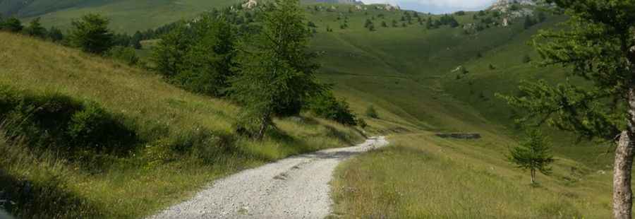
The ascent begins in San Giacomo and covers 17.4 km (10.8 miles). The road is a grueling test for any vehicle, featuring a massive elevation gain of 1,587 meters. This results in a sustained average gradient of 9.12%, with some ramps exceeding 12%. The surface is entirely unpaved, consisting of loose gravel, dirt, and rocky sections. To navigate the 21 sharp hairpin turns and the steep, uneven inclines, a high-clearance 4x4 vehicle is mandatory. The track is narrow and often lacks safety barriers as it winds up the steep Alpine mountainside.
Is the road to the refuge open year-round?
No. Due to its high altitude and location in the northern Italian Alps, the road to La Riposa Refuge is impassable during the winter months. It is typically covered in deep snow from November until late May or early June. Even in the summer, the track is sensitive to weather changes; heavy rain can cause washouts and turn the dirt sections into slippery mud traps. Before departing, it is essential to check the local conditions in the Susa Valley area, as maintenance on this high-altitude track is infrequent.
What are the main hazards on the San Giacomo route?
The primary hazards are brake overheating and engine strain. Climbing 1,587 meters at a 9% grade puts immense pressure on the vehicle's cooling system, especially in the thin air above 2,000 meters. On the descent from La Riposa Refuge, drivers must use low-range gears and engine braking to avoid total brake failure. The road is very narrow in sections, making it difficult to pass oncoming hikers or other 4x4s. Additionally, the higher parts of the route are exposed to rockfalls and have steep unprotected drops into the valley below.
Logistics and Preparation
There are no services, fuel stations, or water along the 17.4 km climb. Ensure your tank is full before leaving the valley floor. Mobile signal can be unreliable due to the surrounding peaks. It is highly recommended to carry a full-size spare tire and basic recovery equipment, as the sharp rocks in the Piedmont region are known for causing punctures. Always yield to mountain rescue or forestry vehicles, which have priority on these restricted-access alpine tracks.