How to drive the old military road to Testa Crevacol?
Testa Crevacol, also known as Tête de Crévacol, is a high mountain peak at an elevation of 2,502m (8,208ft) above sea level in the Aosta Valley, Italy. Located in the Pennine Alps near the Swiss border, the summit is reached via a historical military track known for its loose stone surface and alpine drops.
| Road facts: Testa Crevacol | |
|---|---|
| Location | Saint-Rhémy-en-Bosses, Aosta Valley, Italy |
| Elevation | 2,502 m (8,208 ft) |
| Length from Testa Bassa | 2.3 km (1.42 miles) |
| Average Gradient | 9.17% |
| Access Status | Final section closed to motorized traffic |
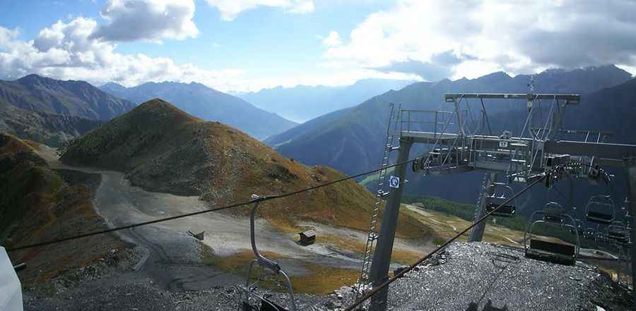
How do you drive from Testa Bassa to the summit of Testa Crevacol?
Starting as a continuation of the steep chairlift track from Testa Bassa, the road to the summit of Testa Crevacol is 2.3 km long. The track gains 211 meters of elevation with a sustained average gradient of 9.17%. The surface consists of old weathered military gravel, loose shale, and rock fragments that make tires spin easily on the steep hairpins, meaning a proper 4x4 with low gears is necessary. The mountain lane is very narrow, offering very few spots to pass another car and clear drop-offs on the outer edge.
What is the history of the military track to Tête de Crévacol?
The road was originally engineered for strategic border surveillance overlooking the Great St Bernard Pass area. The old dry-stone retaining walls that support the roadbed are now decaying and prone to collapse, causing the path to narrow significantly after heavy landslides. A critical detail for drivers is that the final stretch to the actual summit is closed to motorized vehicles to protect the alpine tundra. You must park and turn around before the closure sign, as the track beyond that point is too tight for a standard car to turn around without backing up dangerously close to the cliff edge.
Is the road to Testa Crevacol open in winter?
Set high in the rugged Pennine Alps, the road is completely buried under snow drifts during the winter months and remains blocked until late June. On the descent back to Testa Bassa, you must use first gear and engine braking; relying only on your foot brakes down a continuous 9.17% gravel slope will overheat the system and leave you without brakes on a sheer ridge. Due to its exposure near the Swiss border, high winds and sudden mountain fog can drop visibility to near zero in minutes.
Pic: Emanuele Bredy