A postcard road to Lago di Cancano in Sondrio
Lago di Cancano is a high mountain reservoir at an elevation of 1,920m (6,299ft) above sea level, located in the Province of Sondrio, in Italy. The place is a postcard due to its stunning views.
Where is Lago di Cancano?
The reservoir is located in the Lombardy region, in the northern part of the country, near the Swiss border, within the Parco Nazionale dello Stelvio. Near the lake there’s a mountain refuge known as Rifugio Ristoro Solena.
How old is the road to Lago di Cancano?
This road is very ancient and once was known as the "Salt & Wine Route" and connected Valtellina with Switzerland. It provides access to Torri di Fraele, towers that were originally built in 1391 as part of the fortification system to defend against frequent invasions. They were fortified in the 15th century and mostly destroyed in 1513 during an invasion by the Grisons. The area below the cliff is known as the "Burrone dei Morti" or the ravine of the dead.
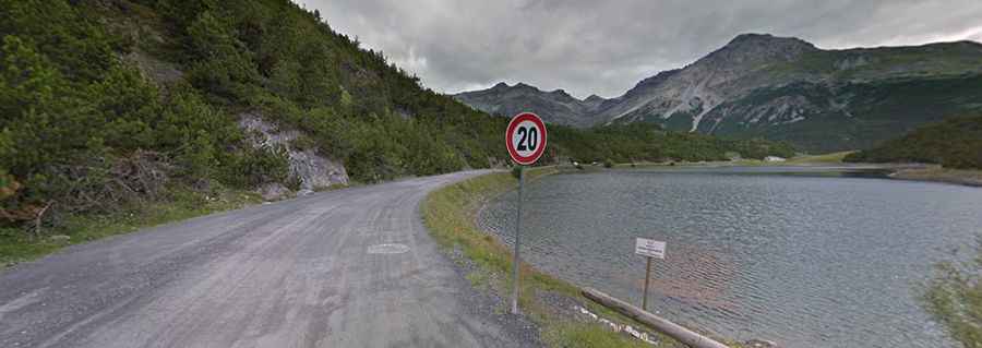
How challenging is the road to Lago di Cancano?
Set high in the Alps, in the Fraele valley, the road comprises paved and unpaved sections, and features many narrow and steep sections, up to 8.3%. Along the way, the road has many hairpin turns, especially on the section near Torri di Fraele. It can be scary for some drivers on the part of the road running along the northern shore of Lago Scale, as it lacks any kind of protections.
How long is the road to Lago di Cancano?
Starting from Premadio, the ascent is 11.4km (7 miles) long. Over this distance, the elevation gain is 573 meters and the average percentage is 5%.