Driving the Polentin Pass: The border road between Austria and Italy
Polentin Pass (Passo Polentin in Italian) is a mountain pass at an elevation of 1,538 meters (5,045 ft) above sea level, located on the border between Austria and Italy. Crossing the Carnic Alps, the pass connects Stranig in Carinthia (Austria) with Paularo in Friuli-Venezia Giulia (Italy).
| Road facts: Polentin Pass / Passo Polentin | |
|---|---|
| Location | Stranig (Austria) to Paularo (Italy) |
| Elevation | 1,538 m (5,045 ft) |
| Length | 25 km (15.5 miles) |
| Surface | Cracked asphalt and hard-packed gravel |
| Access Window | 09:00 - 18:00 (June to mid-October) |
What are the access restrictions on Polentin Pass?
Vehicle access across the pass is restricted by a timed barrier gate. Driving through is only permitted between 09:00 and 18:00, from June to mid-October. Outside these hours, or during the winter closure from November to May, the border gate remains locked with no room for large vehicles to turn around near the summit.
What is the road surface like from Stranig to Paularo?
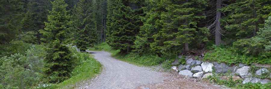
The 25-kilometer cross-border route features a mix of degraded pavement and unpaved track. The Austrian ascent from Stranig consists of narrow, cracked asphalt with deep potholes and frost damage. Near the summit and along the descent, the surface transitions to hard-packed dirt, ruts, and loose gravel, requiring vehicles with sufficient ground clearance to avoid underbody damage.
What are the hazards on the descent to Paularo?
The descent on the Italian side toward Paularo follows a narrow single-lane track along steep mountain slopes. Oncoming traffic, including local forestry vehicles, requires one driver to reverse to a wider turnout. Low gears are necessary on the continuous slope to use engine braking and prevent brake pads from overheating. Rain quickly turns the unpaved gravel sectors slick and muddy.