Strada Militare del Colle della Vecchia is an old military road built in the 1880s
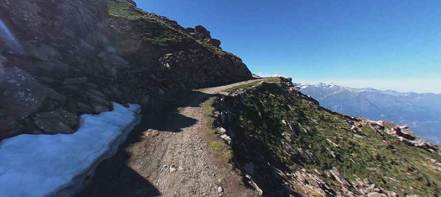
Strada Militare del Colle della Vecchia is an old military road located in the metropolitan city of Turin, built in the 1880s and closed to motor vehicles, winding its way up to 2,000m above sea level.
Where is Strada Militare del Colle della Vecchia?
The road is located in the region of Piedmont, in the northwestern part of the country, near the French border.
When was Strada Militare del Colle della Vecchia closed?
After World War II, the road was officially classified as "un-useful and difficult to maintain" — and thus abandoned. It’s been closed since that time. Along the road, there are several military constructions.
How long is Strada Militare del Colle della Vecchia?
The road is totally unpaved. It is 10.7 km (6.64 miles) long and climbs up to Cima Ciantiplagna (2,849 m) and Colle della Vecchia (2,605 m). It's really steep, with an average gradient of 10.83%.
Where does Strada Militare del Colle della Vecchia start and end?
The road starts from the Strada del Colle delle Finestre (SP172) and finishes near Forte del Gran Serin.