How difficult is the unpaved road to Colle di Perascritta in Italy?
Colle di Perascritta is a high mountain pass at an elevation of 2,154m (7,066ft) above sea level, located in the Piedmont region, in northern Italy. Traversed by the rugged and unpaved Strada Sistina, the pass climbs through the Graian Alps toward Lago del Monastero.
| Road facts: Colle di Perascritta | |
|---|---|
| Location | Chiaves, Turin, Piedmont, Italy |
| Elevation | 2,154 m (7,066 ft) |
| Length | 13.4 km (8.3 miles) |
| Average Gradient | 7.58% |
| Surface | Unpaved / Rough Gravel |
How long is the climb to Colle di Perascritta from Chiaves?
Starting from the mountain village of Chiaves, the ascent is 14.2 km (8.8 miles) long if you follow the track up to the Alpe Costapiana pastures. The road climbs 1,017 meters of vertical elevation, with a continuous 7.58% of average gradient. The asphalt vanishes completely within the first kilometers, turning into a dirt and rock trail that cuts across open alpine meadows before reaching the shores of Lago del Monastero near the pass.
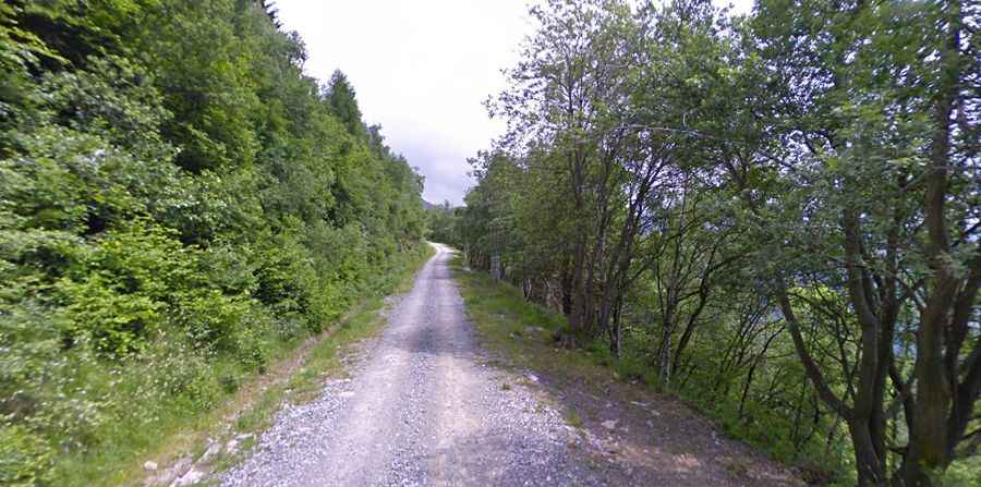
What are the conditions on the Strada Sistina to Lago del Monastero?
The track consists of a mix of loose gravel, crushed shale, and bare soil. Heavy alpine downpours regularly turn the dirt into slick mud, causing tires to spin out on the climbing sections. The road is a single-lane ledge with zero steel barriers, steel fences, or stone walls on the valley side. Small war memorials dot the trailside along the upper switchbacks.
Is the road to Colle di Perascritta open in winter?
Buried under heavy snow packs for most of the year, the Strada Sistina is completely blocked from late October until early June. Local snowplows do not clear this high-altitude dirt track. Even in the middle of summer, deep water ruts from late snowmelt scar the driving line, while sudden high-altitude fog can reduce visibility to the front bumper in a matter of minutes.
Why do you need a 4x4 for Alpe Costapiana?
Standard low-clearance cars will easily beach or strike their oil pans against the sharp, embedded rocks sticking out of the trail. The final ramps to the summit exceed a 12% incline, where the combination of loose rock layers and steep angles requires a four-wheel-drive system to keep forward momentum without destroying the tires or burning out the clutch on the steps.