How to drive the Sentiero Riale to Passo di San Giacomo?
The Passo di San Giacomo is an international high mountain pass at an elevation of 2,313m (7,589ft) above sea level, situated on the border between Italy (Piedmont) and Switzerland (Ticino). Located in the Lepontine Alps, the Italian side is accessed via a high-altitude track known as Sentiero Riale - Passo S. Giacomo. While the Italian sector is motorable with the correct equipment, the Swiss side is strictly a walking path, making the summit a logistical dead-end for vehicles.
| Road facts: Passo di San Giacomo | |
|---|---|
| Location | Italy (Riale) - Switzerland Border |
| Elevation | 2,313m (7,589ft) |
| Length | 9 km (from Riale) |
| Average Gradient | 6.45% |
| Surface | Unpaved (Gravel / Loose stones) |
What is the road condition of Sentiero Riale to Passo di San Giacomo?
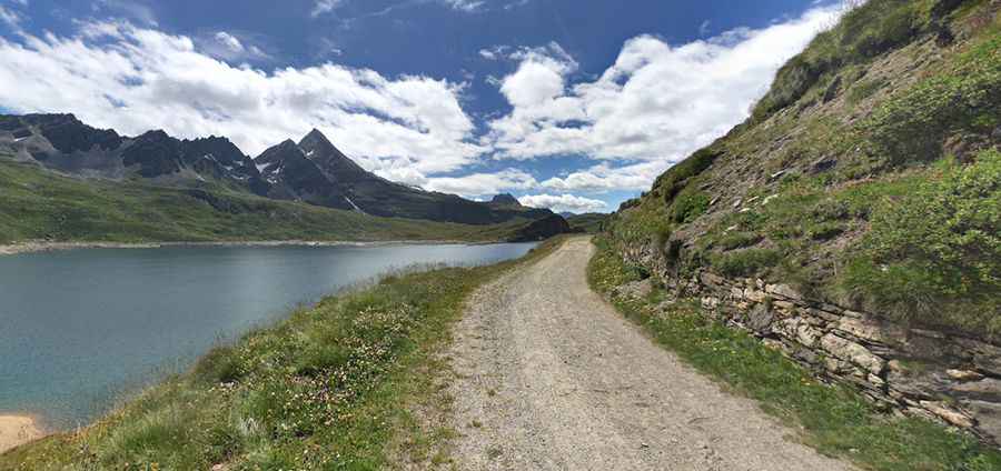
The 9 km ascent from Riale follows a former military road that winds up the mountainside with a series of tight, unpaved hairpins. As seen in the sector passing Lago del Toggia, the surface is composed of stabilized gravel and loose stones. The track is narrow and frequently washed out by snowmelt, requiring a high-clearance 4x4 vehicle to navigate safely. The technical difficulty increases in the upper sections where the roadbed is less maintained and large rocks can obstruct the driving line. There are no guardrails, and the track is impassable from September to June due to heavy snow accumulation.
What are the technical logistics of the Passo di San Giacomo climb?
With an elevation gain of 581 meters over 9 km, the Passo di San Giacomo maintains an average gradient of 6.45%. While the incline is moderate, the high-altitude environment (exceeding 2,300m) affects engine performance, causing a noticeable drop in torque. Drivers must use low-range gears to control the vehicle's speed, especially on the descent to prevent brake overheating. Logistically, the summit is marked by the Ex Caserma della Guardia di Finanza, an abandoned military building. Beyond this point, the motorable road terminates, as the descent into Switzerland is only possible via hiking trails.
How to manage weather hazards at Passo di San Giacomo?
The weather in the Lepontine Alps is highly volatile. Even in mid-summer, sudden thunderstorms can turn the gravel of Sentiero Riale into a slippery surface with zero lateral traction. Visibility can be severely compromised by low clouds at the summit, making it difficult to spot the edges of the narrow track. It is a technical requirement to check the Piedmont regional weather forecast before departure. In case of heavy rain, the track is prone to localized landslides and water flows that can deepen existing ruts, making the transit hazardous for vehicles without high ground clearance.
Which vehicle equipment is needed for Passo di San Giacomo?
A high-clearance 4x4 is mandatory for the Passo di San Giacomo transit. Before starting the 9 km climb from Riale, ensure your tires are in good condition; the sharp alpine stones can easily cause punctures. It is recommended to carry basic recovery gear and a full-size spare tire. Logistically, Riale is the last point for fuel and mechanical support. Ensure your cooling system is functioning correctly, as the sustained climb in low-pressure air puts extra strain on the engine. Self-sufficiency is critical, as the isolation of the border ridge means that any mechanical recovery will be slow and logistically complex.
Pic: Andrea Dellamora