How difficult is the unpaved road to Monte Borzalet in the Italian Alps?
Monte Borzalet is a high mountain summit reaching an elevation of 2,277m (7,470ft) above sea level, located in the Aosta Valley region of north-western Italy. Situated near the Great St Bernard Pass on the border with Switzerland, the road to the summit is a rugged unpaved track that winds through high-altitude pastures and rocky outcrops. This is a technical alpine drive where the steepness of the terrain and the narrowness of the path require a capable 4x4 vehicle and a driver prepared for the unpredictable conditions of the high Alps.
| Road facts: Monte Borzalet | |
|---|---|
| Location | Saint-Rhémy-en-Bosses, Aosta Valley (Italy) |
| Elevation | 2,277 m (7,470 ft) |
| Length | 6.1 km (3.8 miles) from Saint-Rhémy |
| Elevation Gain | 401 m |
| Average Gradient | 6.57% |
How long is the climb from Saint-Rhémy-en-Bosses to Monte Borzalet?
The journey starts from the village of Saint-Rhémy-en-Bosses and covers 6.1 km (3.8 miles) to reach the 2,277m summit. Over this relatively short distance, you face an elevation gain of 401 meters. While the average gradient of 6.57% might seem manageable on paper, the reality of the unpaved surface means that several ramps are much steeper. The track is mostly composed of loose gravel and dirt ruts, requiring constant attention to maintain traction. As you climb toward the Rifugio Frassati—a mountain refuge inaugurated in 2011—the road becomes increasingly narrow, often with stone-walled embankments on one side and unprotected drops on the other.
What are the main hazards on the road to Rifugio Frassati?
The primary hazard of the Monte Borzalet track is its technical narrowness and the lack of passing places. Meeting another vehicle coming down from the refuge can turn into a "hairy" situation where one driver is forced to reverse on a steep, unstable slope. The surface is also sensitive to weather; after a storm, the dirt can turn into a slick slurry, and falling rocks from the limestone peaks above can block the 6.1 km path without warning. Furthermore, the final push toward the summit takes you through open mountain ridges where the wind can be brutal, and the lack of guardrails leaves zero room for error if your vehicle loses grip on the loose stones.
Is the Monte Borzalet road open year-round?
Given its high summit altitude, the road is strictly seasonal and is usually impassable from October to May. During the winter, the track is buried under deep snow and is subject to avalanche risks from the surrounding slopes. Even in early summer, snowbanks can remain in the shaded curves of the forest, making the climb impossible for standard vehicles. The weather in this part of the Aosta Valley is notoriously unpredictable; a sunny start in Saint-Rhémy can quickly transition into a white-out at 2,277 meters. Always check the high-altitude forecast before attempting the drive, as the road is not maintained for winter traffic.
What mechanical preparation is needed for the Aosta highlands?
A high-clearance 4x4 is required for the Monte Borzalet climb to avoid damaging your undercarriage on the large rocks that characterize the upper sections of the track. Your braking system must be in top condition for the 6.1 km descent, where the weight of the vehicle will put constant pressure on the pads—using engine braking is essential to prevent fade. Additionally, check your tire pressure and ensure you have a full-size spare; the sharp alpine shale is known for cutting through sidewalls. In this remote sector of the Aosta Valley, self-reliance is your only insurance policy, as there is no roadside assistance once you leave the asphalt of the main valley.
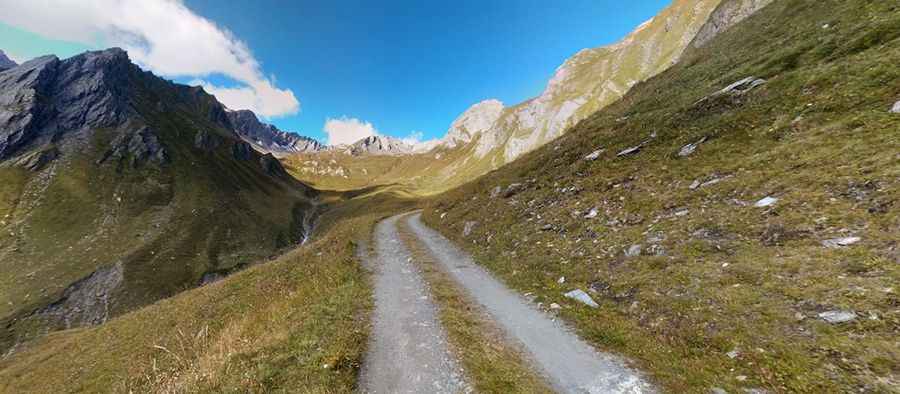
Pic: Maurizio ADAMO