Driving the Kaiserjagerstrasse-Monterovere to Menador Pass
Menador is a high mountain pass at an elevation of 1,269m (4,163ft) above sea level, located in the Autonomous Province of Trento in Italy. The road to the summit is a very challenging drive, not for beginners.
Where is Menador?
The pass is located in the region of Trentino-Alto Adige/Südtirol, in the northern part of the country.
When was the road to Menador built?
The road through the summit is an old military road built in 1911 as a war road from the "Kaiserjäger" to transport materials for the construction of fortifications in the south of the road lying border between Austria-Hungary and Italy, the later Italian front.
Is the road to Menador paved?
The road to the summit is entirely paved. It’s called Strada Provinciale SP 133 di Monterovere, also known as Strada dell’Alpini and Strada del Menador. It’s also known as Kaiserjägerstrasse-Monterovere road.
How long is the road through Menador?
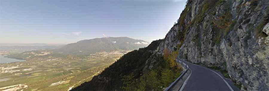
The road is 6.4km (4 miles) long and runs north-south from Lochere to Malga Laghetto. Along the way are beautiful views of Lake Caldonazzo, Levico Lake, and Monte Panarotta.
How challenging is the road through Menador?
Set high in the country's far north, the road is extremely steep in parts, very narrow, and without central marked lines. It’s not a road for beginners and should not be attempted by those who don't know how to reverse. It has several hairpins and two small tunnels. The speed limit is 30 km/h.
Is the Kaiserjägerstrasse-Monterovere road to Menador open?
This road is usually open all year round, but it can be closed anytime when the access is not cleared of snow. It’s closed to vehicles with more than 2.50m height and width.
Road suggested by: Uli