Driving the road to Colletto Pramand in the Alps is not a piece of cake
Colletto Pramand is a high mountain peak at an elevation of 2,145m (7,037ft) above sea level, located in the Metropolitan City of Turin, in Italy.
Where is Colletto Pramand?
The summit is located a few meters from the scary Galleria dei Saraceni, in the region of Piedmont, in the northwestern part of the country.
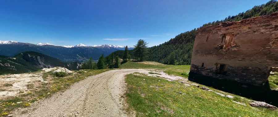
What’s at the summit of Colletto Pramand?
At the summit, there’s an old WWI fort, called Fort Pramand. It was built in 1905. It’s located on a dirt road on the right of the pass and comes off with some hairpins, dating back to the ruins of the fort and then to the grassy esplanade summit.
Is the road to Colletto Pramand unpaved?
The unpaved road to the top is called Via dei Saraceni, also known as Strada militare Fenil-Pramand-Föens-Jafferau and Strada militare 79, and was built in 1886. It’s an old military track with many hairpins and tunnels. This dirt track unfolds for over 20 km, almost entirely over 2,000 meters above sea level. Just for 4x4.
Is the road to Colletto Pramand open in winter?
Set high in the Hautes Alpes, in the southwestern part of the Italian Alps, the road, which climbs up to iconic mountain passes such as Monte Jafferau and Monte Seguret, is open from May to October.
How challenging is the road to Colletto Pramand?
The road follows a route among several forts. The slope of the road is less than 12%, and the width is around 3 meters. There are some fairly rocky sections, not hard but difficult in most cars. If the weather is bad, you would not consider it. The road is passable by off-road vehicles, transit is allowed. The trail is prone to rockfalls, so it can be tricky in places.
Pic: Rafał Kudriawcew