Driving to Col de Saurel: A 2.392m border track in the Cottian Alps
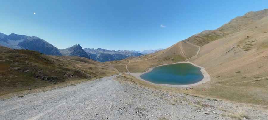
Located on the high-altitude frontier between France and Italy, the track to Col de Saurel is a raw mountain journey in the heart of the Cottian Alps. Reaching an elevation of 2,392m (7,847ft) above sea level, this unpaved route is more than just a border crossing; it is a high-stakes military-origin road that provides access to the crystal waters of Lago di Sette Colori. It is a drive where the mechanical limits of your 4x4 are tested against loose shale and the thin air of the Alpine ridges.
| Road facts: Col de Saurel | |
|---|---|
| Location | France-Italy border (Cottian Alps) |
| Elevation | 2,392 m (7,847 ft) |
| Length | 6.3 km (from Sagna Longa) |
| Average Gradient | 6.36% |
| Surface | Unpaved / Loose stones |
Is the road to Col de Saurel too rough for a standard SUV?
The 6.3 km ascent starting from Sagna Longa is a technical grind that requires high clearance and a low-range gearbox. Although the average gradient is a manageable 6.36%, the reality of the Col de Saurel track is the quality of the terrain. The road is part of the legendary "Clavierissima" route, a mountain circuit known for its punishing rocky surface. Your tires will be constantly fighting for grip on loose scree and jagged stones that have been washed out by Alpine snowmelt. If you attempt this climb in a standard city car, the deep ruts and sharp rocks will likely destroy your oil pan or leave you stranded on the steep ramps leading to the Lago di Sette Colori.
What are the hazards of the Capanna Mautino summit road?
At the 2,392m summit, you will find the Capanna Mautino, a mountain refuge that marks the highest point of the transit. The primary hazard here is the total exposure to the elements; at this altitude, sudden thunderstorms can turn the dry dirt path into a muddy trap in minutes. The track is narrow, with unprotected drops and several "blind" sections where you might encounter mountain bikes or local forestry furgonetes. Navigating the ridge requires absolute focus, as the soft, eroding shoulders of the track offer no safety margin if you lose traction. The view of the lake is magnificent, but the price of admission is a slow, bone-shaking drive that tests your vehicle's suspension to the limit.
How to handle the descent from Col de Saurel to the Italian side?
Coming down from the summit back toward Sagna Longa or Claviere is a test of mechanical preservation. The sustained gradient and the loose surface mean that your brakes can easily lock up on the sliding stones. You must use heavy engine braking and maintain a controlled pace to avoid overshooting the hairpins. Watch your tire pressure; the sharp shale on this Cottian Alps road is notorious for causing punctures. In this remote border zone, you are on your own—there is no cell service in the deep shadows of the peaks, so ensure your vehicle is 100% ready for a technical high-altitude transit before leaving the pavement.
Pic: Paolo Balzarotti