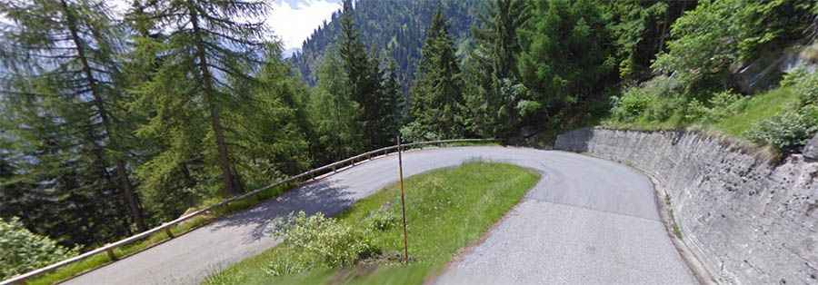
How to drive the the hairpinned paved road to Lago Alpe del Cavalli
Lago Alpe del Cavalli is a high-mountain reservoir at an elevation of 1.508m (4,947ft) above sea level, located in the Italian region Piedmont.
Where is Lago Alpe del Cavalli?
The lake, also known as lago di Cheggio o lago dei Cavalli, was built between 1922 and 1926. It’s located in the Province of Verbano-Cusio-Ossola, in the northwestern part of the country, near the French border. At the end of the road there’s a mountain hut known as Rifugio Città di Novara and a parking lot.
Is the road to Lago Alpe del Cavalli paved?
The road to the lake is fully paved though pretty narrow, and very steep. The road features 26 hairpin turns.
How long is the road to Lago Alpe del Cavalli?
Starting from the town of Antronapiana, at 923m, the ascent is 7,2 km long. Over this distance, the elevation gain is 585 meters. The average percentage is 8,1%.