A 5-star road to Passo Campo Carlo Magno in the Italian Alps
Passo Campo Carlo Magno is a high mountain pass at an elevation of 1.682m (5,518ft) above sea level, located in the Autonomous Province of Trento, in Italy.
Where is Passo Campo Carlo Magno?
The pass is located in Trentino-Alto Adige/Südtirol, in the northern part of the country. The pass links Val Rendena and Val di Sole.
Why is it called Passo Campo Carlo Magno?
The pass is named after Charlemagne, who is said to have crossed the pass on his way to Rome in 800 AD for his coronation as emperor of the Holy Roman Empire. However, it's important to note that this story is based on legend rather than documented historical evidence. The name "Campo Carlo Magno" was officially adopted in 1909, inspired by a fresco depicting Charlemagne in the nearby church of Carisolo. The fresco was created by the Baschenis family, renowned itinerant painters from the Bergamo area.
Why is it called Passo Campo Carlo Magno?
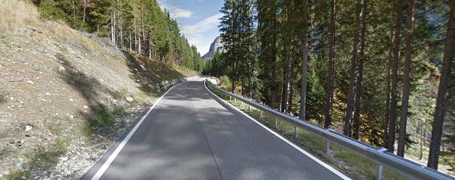
Set high in the Adamello-Brenta mountain region, in the northern Italian Alps, the road to the summit is fully paved in pretty good condition. It’s called Strada Statale 239 (SS239).
How long is Passo Campo Carlo Magno?
The pass road is 30.6 km (19.01 miles) long, running south-north from Pinzolo to Dimaro.
How steep is Passo Campo Carlo Magno?
The road to the summit has been featured in the Giro d’Italia bicycle race. It is pretty steep, hitting an 11.4% gradient through some of the ramps. Starting from Pinzolo, the ascent is 15.3 km long. Over this distance, the elevation gain is 932 meters, with an average gradient of 6.1%. Starting from Dimaro, the ascent is 15.2 km long. Over this distance, the elevation gain is 917 meters, with an average gradient of 6%.