How to drive to Colle della Ciabra in Piedmont?
Colle della Ciabra is a high mountain pass at an elevation of 1,712m (5,616ft) above sea level, located in the Province of Cuneo, in the Italian region of Piedmont.
Where is Colle della Ciabra?
The pass is situated in the Cottian Alps, nestled between the Varaita and Maira valleys. It is a key point on the Strada dei Cannoni (Varaita-Maira-Kammstraße). The summit offers wide views over the Piedmontese plains and the surrounding mountain peaks.
⚠️ Colle della Ciabra Technical Data
| Elevation Gain | 1,117 m |
| Avg. Gradient | 5.7% |
| Surface | Bumpy/Poor Asphalt |
| Road Status | Asphalt ends 100m after summit |
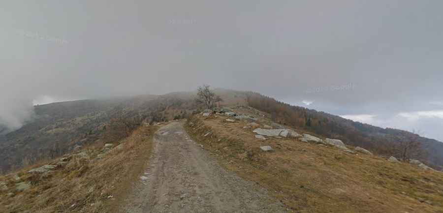
Is the road to Colle della Ciabra paved?
The road to the pass is technically asphalted, but the surface is in very poor condition. The asphalt is extremely thin, weathered, and bumpy.
- The Transition: About 100 meters after the actual pass sign, the asphalt ends completely. This is the official starting point for the unpaved, rugged section of the ridge road.
- Driving Conditions: The road is exceptionally narrow and lonely. It is a "single-track" path where passing another vehicle requires finding one of the few wider spots along the route.
How long is the ascent to Colle della Ciabra?
The most popular and challenging way to reach the pass is from Brossasco, in the Varaita Valley.
- Distance: 19.7 km (12.2 miles).
- Elevation Gain: 1,117 meters.
- Average Gradient: 5.7%.
- Maximum Gradient: Some ramps in the middle section exceed 10-12%, making it a "grueling" climb due to the combination of steepness and bad road surface.