How to get to the summit of Kronplatz-Plan de Corones in South Tyrol?
Kronplatz-Plan de Corones is a high mountain pass at an elevation of 2,275m (7,464ft) above sea level, located in the Autonomous Province of Bolzano – South Tyrol, in Italy.
Where is Kronplatz-Plan de Corones?
The pass is located in the autonomous region of Trentino-Alto Adige/Südtirol, in the northern part of the country, within the Pusteria valley.
Is the road to Kronplatz-Plan de Corones paved?
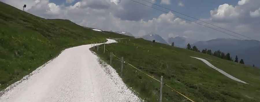
The road to the pass is stunning. It has two very different parts. The beginning of the climb is paved. It’s called Strada Furcia and is 7.6km (4.72 miles) long before Furkelpass - Passo Furcia, at an elevation of 1,789m (5,869 ft) above sea level. The road starts gentle but has a maximum slope of 18% near the end of the asphalt. The second part of the climb is brutal. It’s 5.3km (3.29 miles) of gravel (sterrato).
How steep is the climb to Kronplatz-Plan de Corones?
There are lots of bends, always very steep, and the maximum slope is between 21-24%. The pass has been climbed by the Giro d’Italia bicycle race. Starting from St. Vigil in Enneberg, ascent is 12.9 km (8.01 miles) long. Over this distance, the elevation gain is 1,073 meters. The average percentage is 8.3%.
Pic&video: Gábor Györgyi