Col de Pernante: Driving the historic military border between France and Italy
Situated in the heart of the Maritime Alps, Col de Pernante is an international high mountain pass at an elevation of 1,898m (6,227ft) above sea level. Perched directly on the border between France and Italy, this pass is a key point along the strategic ridge that separates the Roya Valley in France from the Vermenagna Valley in Italy, offering a journey through both stunning Alpine scenery and European military history.
| Road facts: Col de Pernante | |
|---|---|
| Location | France-Italy Border (Maritime Alps) |
| Elevation | 1,898 m (6,227 ft) |
| Length | 600 m from Col de Tende |
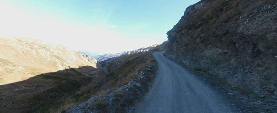
| Surface | Gravel / Unpaved |
| Historical Landmark | Fort Pernante (2,117 m) |
Where is Col de Pernante?
The pass is located on the ridgeline between the Alpes-Maritimes department in southeastern France and the Province of Cuneo in Italy. Access to the pass begins at the world-famous Col de Tende (Colle di Tenda), a historical crossing known for its 46 hairpins. From this main hub, the track to Col de Pernante branches off, following the high-altitude military paths that connect the defensive fortifications of the 19th century.
Is the road to Col de Pernante paved?
No, the road to Col de Pernante is entirely unpaved. It consists of a gravel surface that is generally kept in good condition, as it is part of a popular network for off-road enthusiasts and hikers. The 600-meter stretch from Col de Tende is not excessively steep, making it accessible for most standard 4x4 vehicles. However, drivers should remain cautious as the high-altitude environment means weather can change rapidly, and the gravel can become slippery after mountain storms.
What is at the summit of Col de Pernante?
At the summit, visitors will find the trailhead leading to the imposing Fort Pernante, located slightly higher at an elevation of 2,117m. Built in 1883 as part of the Italian defensive system of the Colle di Tenda, the fort once featured a fully stocked battery designed to protect the border. Although it was disarmed during the First World War to provide artillery for the front lines, the ruins of the fort remain an incredible site to explore. The panoramic views from the fort encompass both the French and Italian peaks, providing a 360-degree look at the rugged landscape that military engineers had to navigate over a century ago.
How challenging is the drive to Col de Pernante?
While the 600-meter track to the pass itself is relatively easy for an experienced driver, the challenge lies in the approach to Col de Tende and the onward journey to the fort. The road is narrow in sections and sits in a very remote area of the Alps. Proper preparation is required, especially regarding fuel and vehicle condition, as there are no facilities at the summit. The descent from the fort area towards the valley requires careful use of engine braking to manage the gravel slopes. It is a drive that combines mechanical simplicity with deep historical resonance, making it a must-visit for those exploring the "Ligne Maginot" or the Italian "Vallo Alpino" fortifications.
Pic: Matteo Quaglia