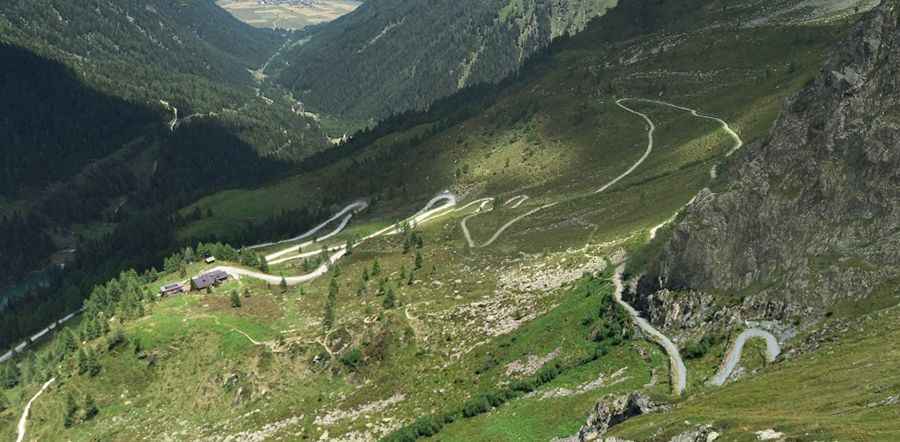
An old military road to the summit of Tilliacher Joch-Forcella Dignas
Tilliacher Joch-Forcella Dignàs is an international high mountain pass at an elevation of 2,094m (6,870ft) above sea level, located on the border between Italy and Austria.
Where is Tilliacher Joch-Forcella Dignàs?
The pass links the Austrian state of Tyrol and the province of Belluno in the Italian region of Veneto, in Val Visdende.
What’s at the summit of Tilliacher Joch-Forcella Dignàs?
Set high in the Alps, at the summit there are old barracks of the Val Cismon battalion, and various remains and war positions from World War I.
How long is Tilliacher Joch-Forcella Dignàs?
The road to the summit is an old military track. It’s 24km (15 miles) long, running south-north from Strada Regionale 355 (SR355), near San Pietro di Cadore in Italy, to Obertilliach, in Austria.
Is the road to Tilliacher Joch-Forcella Dignàs unpaved?
On the Austrian side, the road starts from Obertilliach. The surface of the road is gravel in good condition. The road was resurfaced in 2003. It has some loose gravel. At a gate just before the pass, the road turns more into a wide footpath that is very steep and could be difficult even for 4WD vehicles. On the Italian side, the trail starts from San Pietro di Cadore. The surface of the road is worse. It’s a rocky path, extremely difficult. The road hasn’t been resurfaced. It’s extremely rough, but the asphalt section starts soon.
Pic: Nicolo Bozzella