Sella di Russis: A Narrow Alpine Journey through the Dolomites
Sella di Russis is a high mountain pass at an elevation of 1,729m (5,672ft) above sea level, located in South Tyrol, Italy. Known for its technical driving and stunning Alpine vistas, it is a hidden gem in the heart of the Dolomites.
Where is Sella di Russis?
The pass, also known as Russiskreuz, is located in the Autonomous Province of Bolzano, in the northern part of the country. It serves as a scenic link between the Isarco Valley (Eisacktal) and the Gader Valley (Val Badia), cutting through the rugged Plose mountain massif.
Is the road to Sella di Russis paved?
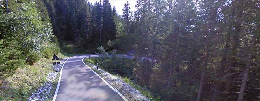
The road through the summit is the Strada Provinciale 29 (SP29). While the surface is totally paved and in good condition, the drive is far from easy. The road is notoriously narrow and very curvy, with several hairpins that require high concentration. In certain sections, the route is carved into steep slopes, leading to a high risk of rock slides, especially after heavy rains or during the spring thaw.
How long is the Sella di Russis pass?
The pass road is 45 km (28 miles) long, running west-east from Bressanone (Brixen) to San Martin de Tor.
- The Ascent: Starting from Bressanone, the road climbs steadily through alpine forests, offering glimpses of the jagged Odle (Geisler) peaks.
- The Summit: At the top, you'll find the Russiskreuz (Russis Cross), a quiet spot far from the heavy traffic of the more famous Dolomite passes.
- Connection: The road is a popular gateway for those heading towards the legendary Passo delle Erbe (Würzjoch).
Is Sella di Russis open in winter?
Due to its high altitude and the risk of avalanches, the road is typically closed during the winter months (November to May). However, the southern side of the mountain remains accessible throughout the winter to provide access to the Plose ski resort, one of the premier skiing destinations in the region.