A steep gravel road to Monte Telegrafo-Plose in the Dolomites
Monte Telegrafo-Plose is a high mountain peak at an elevation of 2,483m (8,146ft) above sea level, located in the Trentino-South Tyrol region of Italy. The summit offers a view of more than 100 mountain peaks.
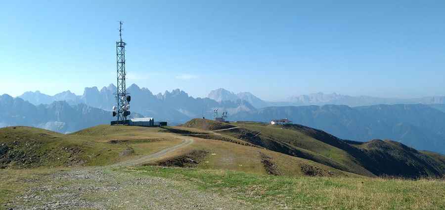
What’s at the summit of Monte Telegrafo-Plose?
The peak is located north of Forcella Luson, in the northern part of the country. The summit hosts communication facilities, a military base, a heliport, a television station, a church, and a mountain hut known as Plosehütte (Rifugio Plose). The Monte Telegrafo radar center, operational during the "Cold War" from 1958 to 1978 (and since then abandoned), was served not only by the road but also by a cable car that rose from the valley.
Is the road to Monte Telegrafo-Plose unpaved?
The road to the summit is called Via Panoramica Dolomiti/Dolomiten Panoramaweg. It’s a mostly gravel road, very narrow, and closed in winter. This road gets worse as you get nearer to the top.
Is the road to Monte Telegrafo-Plose open in winter?
Set high in the Plose range of the Dolomites, the road is usually impassable in winter.
How long is the road to Monte Telegrafo-Plose?
The road to the summit is very steep, hitting a 12% maximum gradient through some of the ramps. Starting at the paved Strada Provinciale 29 (SP-29), the ascent is 9.8 km (6.08 miles) long. Over this distance, the elevation gain is 778 meters. The average gradient is 7.93%.
Is Monte Telegrafo-Plose worth the drive?
The summit offers a stunning 360-degree view over the Dolomites. You’ll be rewarded with a great panoramic view! You’ll be greeted by a fabulous 360-degree panorama of the Dolomites. It’s possible to enjoy a unique vista over the Ötztal Alps, the Zillertal and Stubai Alps, the groups Ortles, Brenta, Adamello, and of course the Dolomites.
Pic: Massimiliano Fattorini