How to get to Lago Miserin, the largest natural lake in Aosta?
Lago Miserin is a remote alpine lake at an elevation of 2,580m (8,464ft) above sea level, located in the Autonomous Region of Aosta Valley, in Italy. It's one of the highest roads in Italy.
Where is Lago Miserin?
The lake, the largest natural lake in Aosta, is located in the upper Champorcher Valley, in the northwestern part of the country. Near the lake, there’s a little mountain hut (Rifugio Misérin) and a sanctuary (Santuario Madonna delle Nevi / Our Lady of the Snow).
How to get to Rifugio Misérin?
Miserin Hut, located at 2,582 m on the shore of Lake Miserin, is a historic refuge within the Mont Avic Regional Park, near the Gran Paradiso National Park along the Alta Via n° 2. Originally dating back to the 17th century, it served as a hospice for pilgrims at the Sanctuary of the Madonna delle Nevi.
How to get to Santuario Madonna delle Nevi?
The Sanctuary of Madonna delle Nevi is said to be the highest sanctuary in Europe. According to legend, shepherds found a statue of the Virgin in the pastures of Cuney and placed it in Lignan, but it miraculously returned to Cuney, signaling the need to build a place of worship there.
How long is the road to Lago Miserin?
Starting from Chateau, the road to the lake is 14.3 km (8.88 miles) long, with an elevation gain of 1,164 meters and an average gradient of 8.13%.
How challenging is the road to Lago Miserin?
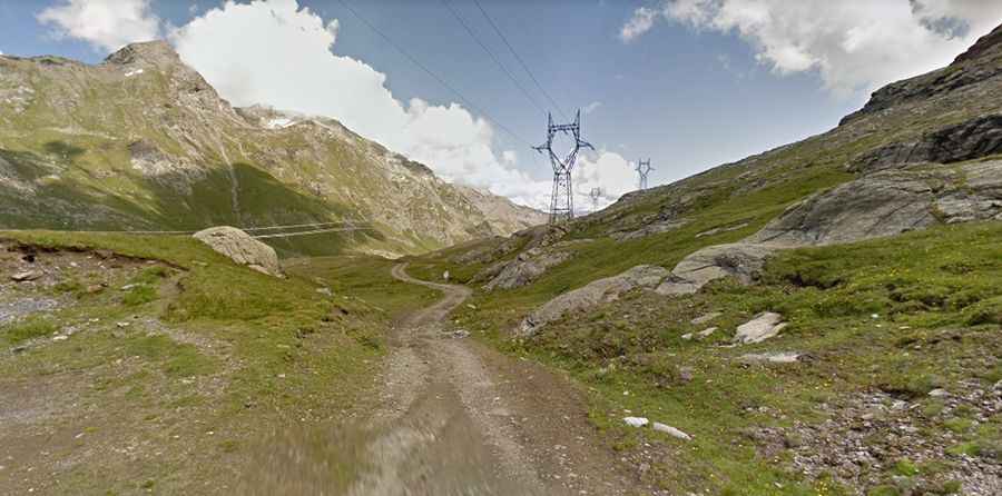
The route is mostly unpaved: the first part is paved, but it soon turns into a bumpy dirt road, often littered with rocks of various sizes. 4x4 vehicles are required for most of the drive. Up to the Dondena refuge, the road is relatively manageable. Beyond the Parcheggio Dondena parking lot, the final 4.9 km are closed to private vehicles. From here, a dirt track to the right of the refuge leads to the lake over 4 km of rugged terrain, including short, steep sections with very rough surfaces, which may require cyclists to push their bikes alongside. Along the way, portions of the route follow the ancient Strada Reale di Caccia (Royal Hunting Road), once used by Vittorio Emanuele II, adding a touch of historical charm to the journey.
Is the road to Lago Miserin open in winter?
Set high in the Graian Alps, a mountain range in the western part of the Alps, the road is totally impassable in winter.