How to get to Genova-Figari Refuge in Cuneo
Rifugio Genova-Figari is a high mountain refuge at an elevation of 2.015m (6,610ft) above sea level, located in the Province of Cuneo, in Italy.
Where is Genova-Figari Refuge?
The refuge is located in the Piedmont region, in the northern part of the country, at the foot of Mount Argentera, which with its 3,297m is the highest summit of the Alpi Marittime.
When was Genova-Figari Refuge built?
The first Genova refuge was built in 1898 on a promontory at an elevation of 1,915 m above sea level, located at the center of the Chiotas basin. It consisted of a masonry building, 8.40 m long, 4.10 m wide, and 4.50 m high from the ground to the base of the roof. It was divided into two rooms: one with 10 bunks used as a dormitory, and the other serving as a kitchen-dining room. The attic was used as a room for alpine guides. The construction cost was approximately 3,000 lire.
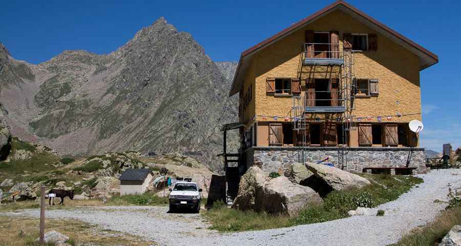
The precise location where the refuge once stood is the area of Gias di Monighet. The basin was flooded in the 1970s following the construction of the Chiotas and Colle Laura dams, which created the current Lake Chiotas. ENEL, the company responsible for the project, replaced the old refuge with the current structure, which was inaugurated in 1981. On the ground floor, the refuge has a restaurant with an annexed bar. The refuge is open non-stop from the 15th of June to the 15th of September.
How long is the road to Genova-Figari Refuge?
The road to the refuge is totally unpaved. A 4x4 vehicle is required, though it’s closed to private vehicles. It is 15.0 km (9.32 miles) long, starting from Entracque. The drive is very steep.
Is Genova-Figari Refuge worth it?
Set high in the Natural Park of the Maritime Alps, the refuge is surrounded by pastures and situated between two lakes: Brocan Lake, of glacial origins, and Chiotàs Lake, supplying one of the largest pumped-storage hydroelectric power stations in Europe.
Pic: Giuseppe De Franco