Valparola Pass is an iconic Giro d'Italia climb
Passo di Valparola is a high mountain pass at an elevation of 2,168m (7,113ft) above sea level, located in the province of Belluno, in Italy.
Where is Valparola Pass?
The pass is located in the Veneto region, in the northeastern part of the country, and connects the summit of Passo di Falzarego, on the side of the Veneto province, with Val Badia, in the province of South Tyrol. The pass marks the divide between the watersheds of the Adige, which flows west into the Adriatic Sea, and the Piave, which flows east.
When was the road through Valparola Pass built?
The road was built during World War I to supply the combat line at the Falzarego zone with weapons and ammunition. Today, the road is well-constructed and in excellent condition, making it easy to ride. Before World War I, there was only a trail over the pass, but the area was heavily contested during the war. A remaining fort has been turned into a museum.
Is Valparola Pass paved?
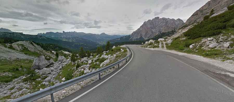
The road to the summit is fully paved and in very good condition. It’s called Strada Provinciale 24 del Passo Valparola (SP24). The road is curvy, with numerous turns, and features very steep sections. The pass has been climbed in the Giro d’Italia bicycle race.
How long is Valparola Pass?
Set high in the Dolomites, the pass is 15.4 km (9.56 miles) long, running from La Villa (Autonomous Province of Bolzano in South Tyrol) to Pian Falzarego (Province of Belluno).