How to drive to Auronzo Refuge in the Dolomites?
Rifugio Auronzo is a high mountain refuge at an elevation of 2.340m (7,677ft) above sea level, located on the boundary between the Trentino-South Tyrol and Veneto regions in Italy.
Where is Rifugio Auronzo?
Rifugio Auronzo is located in the Sexten Dolomites of northeastern Italy. It is the starting point for ascents to the Tre Cime di Lavaredo.
How to get to Rifugio Auronzo?
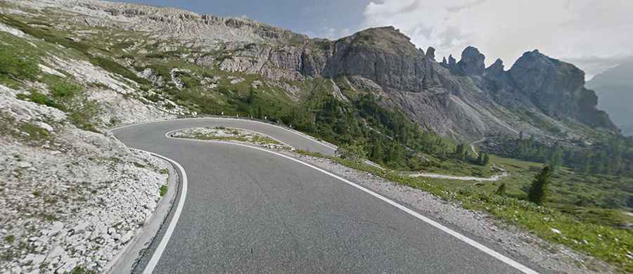
To reach Rifugio Auronzo, travelers use a fully paved toll road known as the Tre Cime di Lavaredo toll road, Three Peaks toll road, or Misurina-Auronzo toll road. The speed limit is 30 km/h. The toll gate is just north of Lago d'Antorno, 1.9 km north of Lake Misurina. From the gate, it is a 5-km drive to the hut.
How long is the road to Rifugio Auronzo?
Starting from the paved SP49 north of Misurina, the road stretches over 7.1 km (4.41 miles) with an elevation gain of 586 meters. The average gradient is 8.25%, with some segments reaching a steep 18%. This route has been part of the Giro d’Italia race.
Is the road to Rifugio Auronzo open?
The road is typically blocked from late October or early November to late May or early June due to snow and other weather conditions.
Is the drive to Rifugio Auronzo worth it?
At the summit, there is a large parking area. The drive offers panoramic views and is known for its stunning landscapes and historical World War I sites. The area is also popular for hiking trails and via ferratas.
Can I drive beyond Rifugio Auronzo?
The paved road ends at Rifugio Auronzo. From there, a difficult footpath leads down the valley or an easier trail can be taken a bit further down the gravel road. The unpaved road from the refuge leads to Rifugio Lavaredo, beyond which cycling on a road bike is not possible.