16 Hairpin Turns to the Summit of Monte Nerone
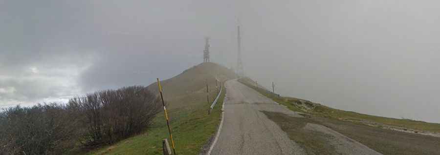
Monte Nerone is a high mountain peak at an elevation of 1,512 m (4,960 ft) above sea level, located in the Province of Pesaro e Urbino in Italy. Sixteen switchbacks lead to the summit, which is marked by television transmission towers.
Where is Monte Nerone?
The peak is located in the Marche region in the eastern part of Italy. At the summit, there is a large parking lot and several communication towers.
Is the Road to Monte Nerone Paved?
The road to the summit is fully paved and includes some steep sections. It is known as Strada Provinciale 15 (SP15) Monte Nerone.
How Long is the Road to Monte Nerone?
Starting from Pian di Trebbio, the road to the summit is 9 km (5.59 miles) long. Over this distance, the elevation gain is 738 m, with an average gradient of 8.20%.
How Steep is the Road to Monte Nerone?
The steepest section of the climb appears just after the first kilometer, reaching 12%. The rest of the climb fluctuates between 7% and 9% gradients, with an average of 8.2%. A series of switchbacks winds around the limestone peak, which bears a slight resemblance to Mont Ventoux.
Is the Road to Monte Nerone Open in Winter?
Set high in the Umbrian Apennines, the road is generally open year-round, though short-term closures in winter are common due to snowfall. The final kilometers are above the tree line and exposed to the elements, with strong winds often playing a critical role.